Calypso, North Carolina facts for kids
Quick facts for kids
Calypso, North Carolina
|
|
|---|---|
 |
|
| Country | United States |
| State | North Carolina |
| County | Duplin |
| Area | |
| • Total | 1.00 sq mi (2.60 km2) |
| • Land | 1.00 sq mi (2.59 km2) |
| • Water | 0.00 sq mi (0.00 km2) |
| Elevation | 161 ft (49 m) |
| Population
(2020)
|
|
| • Total | 327 |
| • Density | 326.67/sq mi (126.12/km2) |
| Time zone | UTC-5 (Eastern (EST)) |
| • Summer (DST) | UTC-4 (EDT) |
| ZIP code |
28325
|
| Area code(s) | 919 |
| FIPS code | 37-09760 |
| GNIS feature ID | 2405366 |
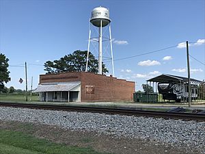
Calypso is a small town located in Duplin County, North Carolina, in the United States. In 2020, about 327 people lived there.
Contents
A Glimpse into Calypso's History
Calypso has a special place in history with the Bryan Whitfield Herring Farm. This farm was added to the National Register of Historic Places in 2001. Being on this list means the farm is an important historical site. It is protected and recognized for its unique past.
Exploring Calypso's Geography
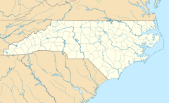
Calypso is found in the northwestern part of Duplin County. A main road, U.S. Route 117, goes right through the town. This road connects Calypso to other nearby places.
- If you head northeast on Route 117, you'll reach Mount Olive in about 4 miles.
- Further northeast, about 18 miles away, is Goldsboro.
- Going south on Route 117, you'll find Faison about 3 miles away.
- About 11 miles south is Warsaw.
There's also U.S. Route 117 Connector. This road goes southwest for about 5 miles to Interstate 40. From Interstate 40, you can travel to bigger cities:
- Wilmington is about 70 miles south.
- Raleigh is about 58 miles north.
The U.S. Census Bureau states that Calypso covers a total area of about 2.6 square kilometers (or 1.0 square mile). All of this area is land.
Who Lives in Calypso? Demographics
The population of Calypso has changed over the years. Here's a quick look at how many people have lived there during different census counts:
| Historical population | |||
|---|---|---|---|
| Census | Pop. | %± | |
| 1920 | 405 | — | |
| 1930 | 538 | 32.8% | |
| 1940 | 678 | 26.0% | |
| 1950 | 688 | 1.5% | |
| 1960 | 633 | −8.0% | |
| 1970 | 462 | −27.0% | |
| 1980 | 689 | 49.1% | |
| 1990 | 481 | −30.2% | |
| 2000 | 410 | −14.8% | |
| 2010 | 538 | 31.2% | |
| 2020 | 327 | −39.2% | |
| U.S. Decennial Census | |||
According to the census from 2000, there were 410 people living in Calypso. These people lived in 178 households. Many of these households (111) were families.
The town is home to a mix of people from different backgrounds. In 2000, the population included:
- About 71.7% White residents.
- About 22.9% African American residents.
- A small number of Native American and Asian residents.
- Some residents identified with two or more races.
- About 4.4% of the population was Hispanic or Latino.
When looking at the age groups in Calypso in 2000:
- About 21% of the people were under 18 years old.
- About 21.7% were 65 years old or older.
- The average age in the town was 41 years.
See also
 In Spanish: Calypso (Carolina del Norte) para niños
 | Isaac Myers |
 | D. Hamilton Jackson |
 | A. Philip Randolph |


