Camasunary facts for kids
Quick facts for kids Camasunary |
|
|---|---|
 |
|
| Civil parish |
|
| Council area | |
| Country | Scotland |
| Sovereign state | United Kingdom |
| Police | Northern |
| Fire | Highlands and Islands |
| Ambulance | Scottish |
| EU Parliament | Scotland |
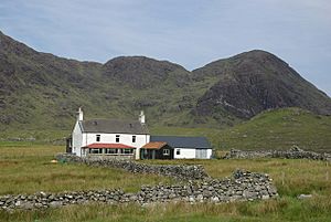
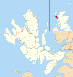
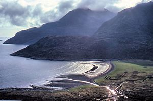
Camasunary is a beautiful bay located on the Strathaird peninsula. This area is part of the Isle of Skye in Scotland. The name Camasunary comes from the Gaelic words Camas Fhionnairigh. This means "Bay of the White Shieling." A shieling was a simple hut used by shepherds in the summer. Today, about 10 ruined houses can be seen in the area.
Contents
What is the Geology of Camasunary?
Underneath Camasunary, there is a special geological feature. It is called the Camasunary Fault. A fault is like a crack in the Earth's crust. This particular fault runs deep under the Isle of Skye. It also extends beneath the Sea of the Hebrides. Geologists study faults to understand how the Earth's plates move.
Fun Activities at Camasunary
Camasunary is a very popular spot for people who love to hike. It offers great access to the Munros of Skye. Munros are Scottish mountains that are over 3,000 feet (914.4 meters) high.
- Bothy: Hikers can find a bothy here. A bothy is a basic shelter that is free to use. It provides a simple place to rest or stay overnight.
- New Bothy: In 2014, a new bothy was built in Camasunary. It replaced an older one. The new bothy was constructed by the Royal Engineers. These are soldiers from the British Army who specialize in engineering tasks.
Where is Camasunary Located?
Camasunary is connected to a place called Kirkibost. You can reach it by an off-road vehicle track. This means the path is rough and not suitable for regular cars. The bay itself is privately owned. However, it is surrounded by land that belongs to the John Muir Trust. This trust is a charity that protects wild places in the UK.
See also
 In Spanish: Camas Fhionnairigh para niños


