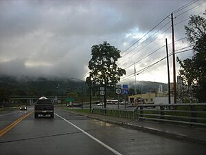
Campbell, New York facts for kids
Quick facts for kids
Campbell, New York
|
|
|---|---|
| Country | United States |
| State | New York |
| County | Steuben |
| Area | |
| • Total | 40.78 sq mi (105.62 km2) |
| • Land | 40.69 sq mi (105.37 km2) |
| • Water | 0.09 sq mi (0.24 km2) |
| Elevation | 1,657 ft (505 m) |
| Population
(2020)
|
|
| • Total | 3,163 |
| • Estimate
(2021)
|
3,121 |
| • Density | 81.04/sq mi (31.29/km2) |
| Time zone | UTC-5 (Eastern (EST)) |
| • Summer (DST) | UTC-4 (EDT) |
| ZIP code |
14821
|
| Area code(s) | 607 |
| FIPS code | 36-11946 |
| GNIS feature ID | 0978780 |
Campbell is a small town located in Steuben County, New York, United States. In 2020, about 3,163 people lived there. The town was named after Robert Campbell, who was an early landowner in the area. You can find Campbell in the center of Steuben County, just northwest of the city of Corning.
Contents
Discovering Campbell's Past
Campbell was first settled around the year 1801. It officially became a town in 1831. It was formed from a part of the nearby town of Hornby.
Historic Places in Campbell
Two important historical spots in Campbell are listed on the National Register of Historic Places. These are the District School Number Five and the Wood Road Metal Truss Bridge. These places are recognized for their historical importance.
Famous People from Campbell
Campbell is known as the birthplace of a couple of notable people.
- Edward J. Brundage was born here in 1869. He later became the Attorney General for the state of Illinois.
- Thomas J. Watson, Sr. was born in Campbell in 1874. He is famous for being the founder of IBM, a very well-known technology company.
Locally, some people call the town "Camp-Bell." This name might have come from a campground that had the same name.
Exploring Campbell's Geography
The town of Campbell covers a total area of about 40.8 square miles (105.6 square kilometers). Most of this area is land, with only a tiny part being water.
Roads and Rivers
Several important routes and a river pass through Campbell.
- Interstate 86, which also includes New York State Route 17, runs through the town.
- New York State Route 415 is another main road here.
- The Cohocton River flows through Campbell.
A road called County Road 333, which used to be New York State Route 333, also enters the town from the west.
Railroad History
Campbell is located on the Gang Mills (Painted Post) Line of the B&H Rail Corporation. This railway line was built in 1882. It was originally part of a larger route that connected New York (Hoboken) to Buffalo. However, in 1963, a part of this route was closed down.
Another railway, the Corning-Rochester line of the Erie Railroad, also served Campbell from about 1853 to 1963. This line was also removed in 1963. These changes were made to encourage more transportation by highway.
Campbell's Population
| Historical population | |||
|---|---|---|---|
| Census | Pop. | %± | |
| 1840 | 852 | — | |
| 1850 | 1,175 | 37.9% | |
| 1860 | 1,622 | 38.0% | |
| 1870 | 1,989 | 22.6% | |
| 1880 | 1,881 | −5.4% | |
| 1890 | 1,533 | −18.5% | |
| 1900 | 1,467 | −4.3% | |
| 1910 | 1,204 | −17.9% | |
| 1920 | 1,032 | −14.3% | |
| 1930 | 1,263 | 22.4% | |
| 1940 | 1,472 | 16.5% | |
| 1950 | 1,814 | 23.2% | |
| 1960 | 2,471 | 36.2% | |
| 1970 | 3,180 | 28.7% | |
| 1980 | 3,801 | 19.5% | |
| 1990 | 3,658 | −3.8% | |
| 2000 | 3,691 | 0.9% | |
| 2010 | 3,406 | −7.7% | |
| 2020 | 3,163 | −7.1% | |
| 2021 (est.) | 3,121 | −8.4% | |
| U.S. Decennial Census | |||
In the year 2000, there were 3,691 people living in Campbell. These people lived in 1,418 households, with 1,036 of them being families. The population density was about 90.6 people per square mile.
About 33.7% of the households had children under 18 living with them. The average household had about 2.59 people. The average family had about 2.99 people.
The population in Campbell is spread out across different age groups. About 26% of the people were under 18 years old. About 12.8% were 65 years old or older. The average age in the town was 38 years.
Communities and Locations in Campbell
The Town of Campbell includes several smaller communities and specific locations.
- Campbell (hamlet) – This is the main village area of Campbell. It's located on the west side of Interstate 86, near the Cohocton River. County Road 125 is its Main Street.
- Coopers Plains – This is a small community that is mostly in the town of Erwin. However, a part of it extends north into Campbell.
- Curtis – You can find this small community south of the Campbell village, along Interstate 86.
- East Campbell – This community is located east of the main Campbell hamlet, along County Road 26.
- Meads Creek – This is both a stream that flows near East Campbell and the name of a small community in the northeast part of the town.
- Michigan Creek – This is a stream that flows into the Cohocton River near the Campbell hamlet.
See also
 In Spanish: Campbell (Nueva York) para niños
 | Aurelia Browder |
 | Nannie Helen Burroughs |
 | Michelle Alexander |


