Canvas Creek facts for kids
Quick facts for kids Canvas Creek |
|
|---|---|
|
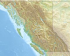
Location in British Columbia
|
|
| Country | Canada |
| Province | Ontario |
| Region | British Columbia Interior |
| Regional District | Thompson-Nicola |
| Physical characteristics | |
| Main source | 2,006 m (6,581 ft) 52°23′32″N 119°24′34″W / 52.39222°N 119.40944°W |
| River mouth | North Thompson River 775 m (2,543 ft) 52°28′50″N 119°17′28″W / 52.48056°N 119.29111°W |
| Basin features | |
| River system | Fraser River |
Canvas Creek is a small waterway, also known as a stream, located in the Thompson-Nicola Regional District in British Columbia, Canada. It's part of the huge Pacific Ocean drainage basin, meaning its water eventually flows into the Pacific. Canvas Creek is a "right tributary" of the North Thompson River, which means it joins the North Thompson River from the right side as you look downstream.
Contents
Journey of Canvas Creek
This creek starts high up on an unnamed mountain slope. It begins about 2,006 meters (6,581 feet) above sea level. From there, it flows mostly towards the northeast.
Where it Flows
After flowing northeast for a while, Canvas Creek makes a curve. It then changes direction and flows towards the northwest. This journey continues until it reaches its end point.
Joining the River
Canvas Creek finally flows into the North Thompson River. This meeting point is about 775 meters (2,543 feet) above sea level. It's located about 11 kilometers (7 miles) west of where the North Thompson River meets the Albreda River. It's also about the same distance from British Columbia Highway 5.
Path to the Ocean
The North Thompson River is a big river that eventually flows into the Thompson River. The Thompson River then joins the mighty Fraser River. Finally, the Fraser River carries all this water all the way to the Pacific Ocean. So, the water from Canvas Creek travels a long way to reach the ocean!
Nearby Park
The very end of Canvas Creek, where it joins the North Thompson River, just touches the edge of North Thompson Oxbows Manteau Provincial Park. This park helps protect the natural areas around the river.
The Name of Canvas Creek
The name "Canvas Creek" was officially recorded on January 29, 1962. However, the name had appeared on maps much earlier, in 1932 and 1942. The interesting thing is that no one knows for sure where the name "Canvas" came from. It's a mystery!
 | Lonnie Johnson |
 | Granville Woods |
 | Lewis Howard Latimer |
 | James West |


