Caprington Loch facts for kids
Quick facts for kids Caprington Loch |
|
|---|---|
| Lua error in Module:Location_map at line 420: attempt to index field 'wikibase' (a nil value). | |
| Location | Earlston, East Ayrshire, Scotland |
| Type | Freshwater loch |
| Primary inflows | Slough & Todrigs Burn, Rainwater & surface drainage |
| Primary outflows | Todrigs Burn |
| Catchment area | Coodham and Dankeith |
| Basin countries | Scotland |
| Surface area | 0.749 acre (1895) |
| Islands | None |
| Settlements | Kilmarnock |
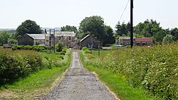
What's left of the old Caprington Loch (NS402352) is found near Earlston in East Ayrshire, Scotland. A loch is a Scottish word for a lake. This loch was a natural lake, sitting in a dip on the land of the old Caprington Castle estate.
The water from the loch flows into the Todrigs Burn. This burn then joins the River Irvine near Gatehead village. The loch was partly drained a long time ago, probably after the 1820s. Many lochs were drained back then to make more land for farming. The small part of the loch that remains today was kept because it was used as a curling pond. The owners of Caprington Castle and their workers used it for fun.
Contents
History of Caprington Loch
Understanding Place Names
You might see old names like 'Lochside' on maps from 1775 and 1821. This was a house located east of the loch. It was not far from the old Treesbank House estate. Today, we don't know exactly where it was.
Other names like 'Tod-holes', 'tod-strips', and 'tod-rigs' were common. 'Tod' is an old Scottish word for a fox. So, these names meant places where foxes often lived. The original 'Tothiricks' farm was located near Peatland, north of Caprington Loch.
The Story of Caprington Loch
Old maps help us learn about the loch. William Roy's map from 1747-1755 doesn't show the loch. But it does show two mills, one of which might have been a windmill. By 1775, the loch appears on maps. A place called 'Tode' is marked near Caprington Castle. West Todrigs Farm might have gotten its name from this 'Tod' element.
Did you know that Todrigs Farm was the birthplace of Johnnie Walker? He became famous for his whisky! His family sold the farm to buy their first grocery shop.
In 1821, maps show a good-sized loch. Templeton farm was to the south, and a burn flowed from the Dankeith estate. The small part of the loch that's left today is near Earlston. It's also close to the old West Todrigs Farm. This farm was used for many years as the Eglinton Hunt Kennels. The loch mainly got its water from the Todrigs Burn and the Slough Burn. These burns start in the Coodham and Dankeith estates.
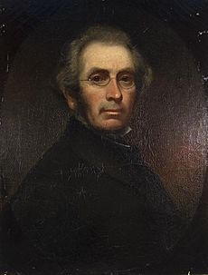
Around 1820, an artist named John Kelso Hunter visited Caprington Loch. He was born in Dankeith. In his life story, he wrote about how inspiring the loch was. He said he stood by the water, looking at the hills. Their blue color was reflected in the calm water. He saw a small hedge and a broken fence going into the loch. A strong old willow tree grew out of the water. Its shape was perfectly mirrored in the clear water. He felt very inspired there, just like any artist would.
Caprington Castle and its land were once owned by the Wallace family. Later, they passed to the Cunninghame family. They owned the estate as baronets from 1669 to 1829. After that, John Smith took the Cunninghame name because his wife inherited the estate.
Todrigs was a corn mill, and later a thrashing mill. It stood on the Todrigs Burn, north of Earlston. The mill got its water from a mill pond near West Todrigs Farm. This pond has since been filled in. The curling pond at West Todrigs Farm was a bit unusual. It had an irregular shape because it was the lowest part of the old loch. It sits very close to the farm house. Maps from 1897 and 1908 show it. The Todrigs Burn supplied water to it, or flowed past the mill.
The old main road from Ayr to Kilmarnock and Glasgow ran quite close to the loch. So, the area was not as isolated as it is today.
Mining History
The Newcomen Engine
The 1908 OS map shows two mine shafts near a square water tank. This tank marks the spot of a very old machine from the 1770s. It was a Newcomen atmospheric pumping engine. This engine helped drain the Caprington coalfield. The engine itself was in Earlston. Today, you can see this amazing engine at the National Museum of Scotland.
The Newcomen engine worked almost non-stop for about 90 years! Its wooden beam was even replaced with a stronger cast-iron one in 1837. We don't know exactly where the water it pumped went. But there was a square tank nearby. The water might have been piped from there down to the old loch site, joining the burn.


