Captain Cook, Hawaii facts for kids
Quick facts for kids
Captain Cook, Hawaii
|
|
|---|---|
 |
|

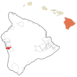
Location in Hawaii County and the state of Hawaii
|
|
| Country | United States |
| State | Hawaii |
| County | Hawaii |
| Area | |
| • Total | 12.86 sq mi (33.30 km2) |
| • Land | 12.86 sq mi (33.30 km2) |
| • Water | 0.00 sq mi (0.00 km2) |
| Elevation | 1,250 ft (381 m) |
| Population
(2020)
|
|
| • Total | 3,253 |
| • Density | 253.03/sq mi (97.70/km2) |
| Time zone | UTC−10 (Hawaii-Aleutian) |
| ZIP Code |
96704
|
| Area code(s) | 808 |
| FIPS code | 15-03850 |
| GNIS feature ID | 0358717 |
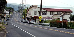
Captain Cook is a small community in Hawaiʻi County, Hawaii, in the United States. It's located in the South Kona area. The town got its name because its post office was once inside the Captain Cook Coffee Co. in the early 1900s.
In 2020, about 3,253 people lived here. There was a plan in 2022 to change the town's name to "Kaʻawaloa," which means "long landing place."
| Top - 0-9 A B C D E F G H I J K L M N O P Q R S T U V W X Y Z |
Where is Captain Cook?
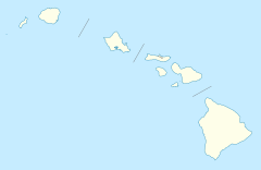
Captain Cook is on the west side of the Big Island of Hawaii. It's next to Kealakekua to the north and Honaunau-Napoopoo to the south.
Hawaii Route 11 goes through the town. This road leads about 12 miles north to Kailua-Kona. It also goes about 47 miles south to Naalehu. Another road, Hawaii Route 160, starts in Captain Cook and winds down about 4 miles to Napoopoo on Kealakekua Bay.
The Captain Cook area covers about 12.86 square miles (33.3 square kilometers) of land. There is no water within its borders.
Why is Captain Cook a great place for coffee?
Most of Captain Cook is located between 800 and 2,000 feet (240 and 610 meters) above sea level. This elevation is perfect for growing coffee. The town sits on top of an old fault line, which helped create the famous Kealakekua Bay.
Before the 1960s, much of Captain Cook was part of the large Kealakekua Ranch. This ranch was started in the 1850s by an English immigrant named Henry Nicholas Greenwell.
Who lives in Captain Cook?
| Historical population | |||
|---|---|---|---|
| Census | Pop. | %± | |
| 2020 | 3,253 | — | |
| U.S. Decennial Census | |||
In 2010, there were 3,429 people living in Captain Cook. The area had about 281 people per square mile.
The people living in Captain Cook come from many different backgrounds. Many residents are White, Asian, or Native Hawaiian and Pacific Islander. A good number of people are also from two or more races. About 9.5% of the population is Hispanic or Latino.
The average household in Captain Cook had about 2.73 people. About 22% of households had children under 18 living with them.
The community has people of all ages. About 20.6% of the population was under 18 years old. About 17.1% of the population was 65 years or older.
Lava Zones and Insurance
Captain Cook is located on an active volcano, just like the District of Puna. Because of this, some parts of the land are in "Lava Flow Hazard Zone 2." This means there is a higher risk of lava flows.
New lava hazard zones are being created to help people understand the risks better. This also helps to reduce "redlining." Redlining is when it's harder or more expensive for people in certain areas to get things like insurance because of where they live.
Places to Visit
Captain Cook has several interesting places to visit:
- Amy B. H. Greenwell Ethnobotanical Garden: A garden where you can learn about traditional Hawaiian plants.
- Koa Coffee Plantation: A place to see how coffee is grown and made.
- Kona Coffee Living History Farm: A farm that shows what life was like on a coffee farm long ago.
- Rodney J. T. Yano Memorial Hall: A community hall named after a local hero.
Education
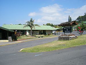
The Hawaii Department of Education runs Konawaena Elementary School, which is located in Captain Cook.
Konawaena Middle School and Konawaena High School are on a campus that is partly in Captain Cook and partly in the nearby community of Kealakekua.
See also
 In Spanish: Captain Cook para niños
 | Claudette Colvin |
 | Myrlie Evers-Williams |
 | Alberta Odell Jones |


