Carl Junction, Missouri facts for kids
Quick facts for kids
Carl Junction, Missouri
|
|
|---|---|

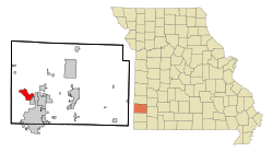
Location of Carl Junction, Missouri
|
|
| Country | United States |
| State | Missouri |
| County | Jasper |
| Area | |
| • Total | 5.61 sq mi (14.52 km2) |
| • Land | 5.47 sq mi (14.17 km2) |
| • Water | 0.13 sq mi (0.34 km2) |
| Elevation | 856 ft (261 m) |
| Population
(2020)
|
|
| • Total | 8,143 |
| • Density | 1,488.12/sq mi (574.56/km2) |
| Time zone | UTC-6 (Central (CST)) |
| • Summer (DST) | UTC-5 (CDT) |
| ZIP code |
64834
|
| Area code(s) | 417 |
| FIPS code | 29-11368 |
| GNIS feature ID | 2393742 |
Carl Junction is a city located in Jasper County, Missouri, in the United States. It's a place where about 8,143 people lived according to the 2020 census.
Contents
History of Carl Junction
Carl Junction was founded by a man named Charles Skinner. He named the town "Carl" after his German first name. It was set up near a railroad junction, which is where different train tracks meet.
A post office has been open in Carl Junction since 1878. This means people have been sending and receiving mail there for a very long time!
Tornadoes in Carl Junction
Carl Junction has experienced some strong tornadoes. On May 4, 2003, an F3 tornado hit the city. Later, on May 22, 2019, an EF3 tornado caused damage to several buildings. These events show how powerful nature can be.
Geography of Carl Junction
Carl Junction is a city that covers about 5.61 square miles (14.52 square kilometers). Most of this area is land, with a small part being water.
The city is located about eight miles away from Joplin. This means it's pretty close to a larger city, which can be handy for shopping or other activities.
Population and People
Carl Junction is part of the Joplin Metropolitan Area. This means it's connected to the larger Joplin area, which includes several towns and cities.
| Historical population | |||
|---|---|---|---|
| Census | Pop. | %± | |
| 1890 | 699 | — | |
| 1900 | 1,177 | 68.4% | |
| 1910 | 1,115 | −5.3% | |
| 1920 | 1,377 | 23.5% | |
| 1930 | 1,042 | −24.3% | |
| 1940 | 1,039 | −0.3% | |
| 1950 | 1,006 | −3.2% | |
| 1960 | 1,220 | 21.3% | |
| 1970 | 1,661 | 36.1% | |
| 1980 | 3,937 | 137.0% | |
| 1990 | 4,123 | 4.7% | |
| 2000 | 5,294 | 28.4% | |
| 2010 | 7,445 | 40.6% | |
| 2020 | 8,143 | 9.4% | |
| U.S. Decennial Census | |||
What the 2020 Census Shows
The 2020 United States census counted 8,143 people living in Carl Junction. There were 2,766 households, which are like homes where people live. Out of these, 2,005 were families.
- Most people in Carl Junction are white (about 87.3%).
- There are also people who identify as black or African-American (0.9%), Native American (1.71%), and Asian (0.82%).
- About 8.35% of the population identified as being from two or more races.
- A small number of people (0.2%) were Hispanic or Latino.
Many households (40.3%) had children under 18 living there. About half of the households (49.9%) were married couples. The average household had about 3 people.
The median age in Carl Junction was 34.7 years. This means half the people were younger than 34.7 and half were older. About 34.5% of the population was under 18 years old.
What the 2010 Census Showed
In 2010, there were 7,445 people living in Carl Junction. The population density was about 1,358.6 people per square mile.
- About 93.3% of the people were White.
- Other groups included African American (1.0%), Native American (1.3%), and Asian (1.0%).
- About 2.9% of the population was Hispanic or Latino.
Many households (45.5%) had children under 18. The average household size was 2.84 people. The median age was 34.7 years, similar to 2020. About 31.4% of residents were under 18 years old.
See also

- In Spanish: Carl Junction (Misuri) para niños
 | Audre Lorde |
 | John Berry Meachum |
 | Ferdinand Lee Barnett |

