Carrsville, Kentucky facts for kids
Quick facts for kids
Carrsville, Kentucky
|
|
|---|---|

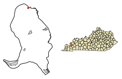
Location in Livingston County, Kentucky
|
|
| Country | United States |
| State | Kentucky |
| County | Livingston |
| Area | |
| • Total | 0.07 sq mi (0.17 km2) |
| • Land | 0.07 sq mi (0.17 km2) |
| • Water | 0.00 sq mi (0.00 km2) |
| Elevation | 371 ft (113 m) |
| Population
(2020)
|
|
| • Total | 48 |
| • Density | 738.46/sq mi (284.57/km2) |
| Time zone | UTC-6 (Central (CST)) |
| • Summer (DST) | UTC-5 (CDT) |
| ZIP code |
42081
|
| Area code(s) | 270 & 364 |
| FIPS code | 21-13060 |
| GNIS feature ID | 2404001 |
Carrsville is a small city located next to the Ohio River in Livingston County, Kentucky, in the United States. It is a "home rule-class city," which means it has the power to govern itself in local matters.
In 2010, the population of Carrsville was 50 people. By 2020, it had slightly decreased to 48 people. Carrsville is part of the larger Paducah metropolitan area. It is situated just west of where Buck Creek flows into the Ohio River.
Contents
Geography of Carrsville
Carrsville is located in the northern part of Livingston County. If you look north across the Ohio River, you will find Hardin County, Illinois.
River Crossings and Nearby Bridges
The closest way to cross the Ohio River from Carrsville is the Cave-In-Rock Ferry. This ferry is about 13 miles (21 km) upstream, or to the east. For bridges, the nearest one over the Ohio River is the Shawneetown Bridge. It is about 36 miles (58 km) upriver at Old Shawneetown, Illinois. The Brookport Bridge is another option, located about 43 miles (69 km) downriver at Paducah.
Roads and Area Size
Kentucky Route 135 runs through Carrsville. This road goes east for about 14 miles (23 km) to Kentucky Route 91, which is near the Cave-In-Rock Ferry. It also goes south for about 12 miles (19 km) to U.S. Route 60 at Burna.
According to the United States Census Bureau, the total area of Carrsville is very small. It covers about 0.07 square miles (0.17 square kilometers), and all of this area is land.
Origin of the Name
Carrsville was named after a person called Billy Karr. He was the one who planned and laid out the town around the year 1840.
Population Changes Over Time
| Historical population | |||
|---|---|---|---|
| Census | Pop. | %± | |
| 1880 | 178 | — | |
| 1890 | 240 | 34.8% | |
| 1900 | 278 | 15.8% | |
| 1910 | 298 | 7.2% | |
| 1920 | 323 | 8.4% | |
| 1930 | 300 | −7.1% | |
| 1940 | 243 | −19.0% | |
| 1950 | 205 | −15.6% | |
| 1960 | 166 | −19.0% | |
| 1970 | 110 | −33.7% | |
| 1980 | 99 | −10.0% | |
| 1990 | 98 | −1.0% | |
| 2000 | 64 | −34.7% | |
| 2010 | 50 | −21.9% | |
| 2020 | 48 | −4.0% | |
| U.S. Decennial Census | |||
Carrsville has seen its population change quite a bit over the years. In 1880, there were 178 people living there. The population grew steadily until 1920, when it reached its highest point with 323 residents. After that, the number of people living in Carrsville began to decline. By 2020, the population was 48 people.
Life in Carrsville (Based on 2000 Data)
In the year 2000, there were 64 people living in Carrsville. These people lived in 35 different homes, and 17 of these homes were families.
Many homes were made up of individuals living alone. Some homes had married couples living together. A small number of homes had a female head of the household without a husband present.
The people in Carrsville represented different age groups. About 14% of the population was under 18 years old. About 25% of the people were 65 years old or older. The median age, which is the middle age of all the people, was 48 years old. This means half the people were younger than 48 and half were older.
See also
 In Spanish: Carrsville (Kentucky) para niños
 | Laphonza Butler |
 | Daisy Bates |
 | Elizabeth Piper Ensley |

