
Hardin County, Illinois facts for kids
Quick facts for kids
Hardin County
|
|
|---|---|

Hardin County Courthouse in Elizabethtown
|
|

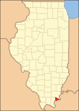
Location within the U.S. state of Illinois
|
|
 Illinois's location within the U.S. |
|
| Country | |
| State | |
| Founded | 1839 |
| Named for | Hardin County, Kentucky |
| Seat | Elizabethtown |
| Largest city | Rosiclare |
| Area | |
| • Total | 182 sq mi (470 km2) |
| • Land | 178 sq mi (460 km2) |
| • Water | 4.1 sq mi (11 km2) 2.2% |
| Population
(2020)
|
|
| • Total | 3,649 |
| • Density | 20/sq mi (8/km2) |
| Time zone | UTC−6 (Central) |
| • Summer (DST) | UTC−5 (CDT) |
| Congressional district | 12th |

Hardin County is a county located in the U.S. state of Illinois. It is in the southern part of the state, an area sometimes called Little Egypt. In 2020, about 3,649 people lived here. This makes it the county with the fewest people in Illinois.
The main town and county seat is Elizabethtown. Hardin County got its name from Hardin County, Kentucky. That county was named after Colonel John Hardin. He was an officer who fought in the American Revolutionary War.
Contents
History of Hardin County
Hardin County was created in 1839. It was formed from parts of Pope County. Later, more land was added from Gallatin County.
The county is named after Colonel John Hardin. He was an important officer in the American Revolutionary War. Sadly, he died in 1792 during a peace mission for President George Washington. This happened in what is now Shelby County, Ohio.
In the past, especially in the 1790s and early 1800s, the area around Cave-In-Rock was known for outlaws and tricky characters.
-
Hardin County between 1839 and 1847
-
Hardin in 1847, when it grew to its current size


Geography and Nature

Hardin County has a total area of about 182 square miles. Most of this (178 square miles) is land. The rest (4.1 square miles) is water. It is the second-smallest county in Illinois by land area.
Hicks Dome Geological Feature
Hicks Dome is a special geological spot in Hardin County. It's a dome-shaped uplift in the land. Scientists believe the older rocks at its center were pushed up by deep underground activity. This activity might also be why there are Fluorspar deposits in the area. Fluorspar, also called calcium fluoride, was mined in Hardin County until the early 1990s.
Local Climate and Weather
| Weather chart for Elizabethtown, Illinois | |||||||||||||||||||||||||||||||||||||||||||||||
|---|---|---|---|---|---|---|---|---|---|---|---|---|---|---|---|---|---|---|---|---|---|---|---|---|---|---|---|---|---|---|---|---|---|---|---|---|---|---|---|---|---|---|---|---|---|---|---|
| J | F | M | A | M | J | J | A | S | O | N | D | ||||||||||||||||||||||||||||||||||||
|
3.5
41
21
|
3.7
47
24
|
4.7
57
33
|
4.8
68
42
|
5
76
52
|
4.2
84
60
|
4.2
87
65
|
3.5
87
63
|
3.2
80
55
|
3.2
70
43
|
4.4
57
34
|
4.3
46
25
|
||||||||||||||||||||||||||||||||||||
| temperatures in °F precipitation totals in inches source: The Weather Channel |
|||||||||||||||||||||||||||||||||||||||||||||||
|
Metric conversion
|
|||||||||||||||||||||||||||||||||||||||||||||||
The weather in Elizabethtown, the county seat, changes throughout the year. In January, temperatures usually range from 21°F to 41°F. In July, they are warmer, from 65°F to 87°F.
The coldest temperature ever recorded was -22°F in January 1994. The hottest was 104°F in August 2007. The county gets a good amount of rain, with May usually being the wettest month.
Neighboring Counties
Hardin County shares borders with several other counties:
- Gallatin County (north)
- Union County, Kentucky (east)
- Crittenden County, Kentucky (south)
- Livingston County, Kentucky (southwest)
- Pope County (west)
- Saline County (northwest)
Main Roads and Transportation
- Rides Mass Transit District
 Illinois Route 1
 Illinois Route 34
 Illinois Route 146
Protected Natural Areas
Part of the Shawnee National Forest is located in Hardin County. This is a large forest area protected by the government.
People and Population
| Historical population | |||
|---|---|---|---|
| Census | Pop. | %± | |
| 1840 | 1,378 | — | |
| 1850 | 2,887 | 109.5% | |
| 1860 | 3,759 | 30.2% | |
| 1870 | 5,113 | 36.0% | |
| 1880 | 6,024 | 17.8% | |
| 1890 | 7,234 | 20.1% | |
| 1900 | 7,448 | 3.0% | |
| 1910 | 7,015 | −5.8% | |
| 1920 | 7,533 | 7.4% | |
| 1930 | 6,955 | −7.7% | |
| 1940 | 7,759 | 11.6% | |
| 1950 | 7,530 | −3.0% | |
| 1960 | 5,879 | −21.9% | |
| 1970 | 4,914 | −16.4% | |
| 1980 | 5,383 | 9.5% | |
| 1990 | 5,189 | −3.6% | |
| 2000 | 4,800 | −7.5% | |
| 2010 | 4,320 | −10.0% | |
| 2020 | 3,649 | −15.5% | |
| 2023 (est.) | 3,569 | −17.4% | |
| U.S. Decennial Census 1790-1960 1900-1990 1990-2000 2010-2017 |
|||

In 2010, there were 4,320 people living in Hardin County. Most people (97.3%) were white. About 1.3% of the population was of Hispanic or Latino background.
Many families live in Hardin County. About 26% of households had children under 18 living with them. The average age of people in the county was about 46.3 years old.
Towns and Communities
Cities in Hardin County
Villages in Hardin County
Other Communities
Hardin County also has several smaller, unincorporated communities. These are places that are not officially cities or villages.
- Cadiz
- Eichorn
- Finneyville
- Gross
- Hicks
- Karbers Ridge
- Lamb
- Loves Corner
- Peters Creek
- Rock Creek
- Saline Landing
- Shetlerville
- Sparks Hill
Historical Places (Ghost Towns)
Some places in Hardin County used to be towns but are now abandoned or have very few people. These are sometimes called "ghost towns."
- Battery Rock
- Chambers Creek
- Fairview Landing
- Grosville
- Hall Ridge
- Hester
- Illinois Furnace
- Lambtown
- Martha Furnace
- McFarlan
- Parkinson's Landing
- Robin's Ferry
- Sellers
- Sellers Landing
- Twitchell's Mills
- Wolrab Mills
Notable People from Hardin County
- James Karber (1914–1976), an Illinois lawyer and politician.
- Jennifer Rhodes (1947-), a television and film actress from Rosiclare.
See also
 In Spanish: Condado de Hardin (Illinois) para niños
