Castleton Tower facts for kids
Quick facts for kids Castle Rock |
|
|---|---|

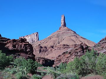
South Face of Castle Rock viewed from the approach. In the background to the left is a rock formation commonly known as The Priest and Nuns.
|
|
| Highest point | |
| Elevation | 6,660 feet (2,030 m) NAVD 88 |
| Prominence | 1,496 ft (456 m) |
| Geography | |
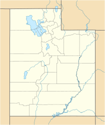
| Location | Grand County, Utah, U.S. |
| Topo map | Fisher Towers |
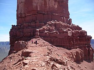
Castleton Tower is a tall rock formation in Utah, USA. It stands about 400 feet (120 meters) high, like a giant stone pillar. This amazing tower is made of a type of rock called Wingate Sandstone. It sits on top of a 1,000-foot (300-meter) cone-shaped hill.
Castleton Tower is famous around the world. Many people love to take pictures of it because it looks so cool. It's also a very popular spot for rock climbing. One of its most famous climbing routes is called the Kor-Ingalls Route. You can find this route in a famous climbing book called Fifty Classic Climbs of North America. You can get to Castleton Tower by following a path that starts near a simple camping area.
Contents
Where is Castleton Tower?
Castleton Tower is located at the end of a long, high area of land. This area is mostly made of red sand, small rocks, and some short cliffs. The tower itself is about 40 feet wide and 400 feet tall.
Near Castleton Tower, there's another large rock formation called The Rectory. It's similar in height but much wider. Sometimes, parts of The Rectory are called The Priest and Nuns.
The closest town to Castleton Tower is Moab, Utah. It's about 10 miles (16 kilometers) away. Most people get to the area by taking Castleton Road, which is off Utah State Route 128. This road runs along the Colorado River.
From Castleton Tower, you can see other cool places. To the southeast, you might spot the La Sal Mountains. To the northeast, you can see the Fisher Towers. The Colorado River and its cliffs are to the northwest.
Climbing Castleton Tower
Castleton Tower is one of the most popular places in the world for rock climbing. Thousands of climbers have reached its top. Some experts believe over 40,000 people have successfully climbed it!
The very first time someone climbed to the top was on September 16, 1961. Two climbers named Layton Kor and Huntley Ingalls did it. Their climbing path is still one of the most popular ways to get to the top. It's called the Kor-Ingalls Route. This route is rated 5.9 on the Yosemite Decimal System, which is a way to describe how hard a climb is.
Today, there are many different climbing paths on all sides of the tower. Each path has its own name and challenge.
Protecting Castleton Tower
For a long time, much of the land around Castleton Tower was owned by a group called the Utah School and Institutional Trust Lands Administration (SITLA). This group manages state land and sometimes sells or leases it to help fund schools in Utah.
In 1999, SITLA planned to sell some land near Castleton Tower. A company wanted to buy it and build houses there. This would have meant closing the camping area and making it harder for people to visit the tower.
But people wanted to protect this special place. So, a group called the Castle Rock Collaboration (CRC) was formed. They worked with another non-profit group called the Utah Open Lands Conservation Association. Over two years, these groups raised enough money to buy the land back from the developers.
Thanks to their efforts, over 221 acres (0.89 square kilometers) of land around Castleton Tower are now protected. This includes the primitive camping area that climbers use. The Utah Open Lands now owns and manages this land, making sure it stays open for everyone to enjoy.
Images for kids
See also
 In Spanish: Castleton Tower para niños
 | Calvin Brent |
 | Walter T. Bailey |
 | Martha Cassell Thompson |
 | Alberta Jeannette Cassell |


