Chain Island facts for kids

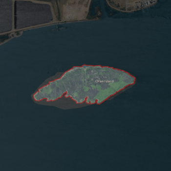
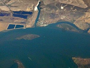
USGS aerial imagery of Chain Island
|
|
| Geography | |
|---|---|
| Location | Northern California |
| Coordinates | 38°04′11″N 121°51′11″W / 38.06972°N 121.85306°W |
| Adjacent bodies of water | Sacramento–San Joaquin River Delta |
| Highest elevation | 0 ft (0 m) |
| Administration | |
|
United States
|
|
| State | |
| County | Sacramento |

Chain Island is a small island located in Suisun Bay. This bay is a part of San Francisco Bay, found just downstream from the Sacramento–San Joaquin River Delta. It's a cool spot in Northern California.
Chain Island is part of Sacramento County. This means it's managed by the government of that county. Interestingly, it's not part of a special group called a "reclamation district." These districts usually manage land that has been reclaimed from water.
The island's exact location is at coordinates 38°04′11″N 121°51′11″W / 38.06972°N 121.85306°W. In 1981, the United States Geological Survey (USGS) measured its elevation. They found that Chain Island is at sea level, meaning its elevation is 0 ft (0 m).
About Chain Island
Chain Island is a natural landform in the large water system of California. It's surrounded by the waters of Suisun Bay. This area is important for wildlife and the environment.
Where is Chain Island?
Chain Island is located in the western part of the Sacramento–San Joaquin River Delta. This delta is where the Sacramento and San Joaquin Rivers meet. They then flow into San Francisco Bay. Suisun Bay is a key part of this journey to the ocean.
The island is found in Sacramento County. This county is in the central part of California. It's known for its rich agricultural lands and waterways.
What is its Elevation?
The elevation of Chain Island is 0 feet (0 meters). This means the island is at the same level as the surrounding water. Islands at sea level can be affected by tides and water levels. The United States Geological Survey (USGS) is a science agency. They study the Earth's landscape and natural resources.
 | Aurelia Browder |
 | Nannie Helen Burroughs |
 | Michelle Alexander |


