Cheeks Hill facts for kids
Quick facts for kids Cheeks Hill |
|
|---|---|

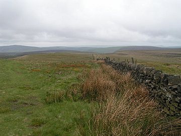
Cheeks Hill summit from the Staffordshire side
|
|
| Highest point | |
| Elevation | 520 m (1,710 ft) |
| Geography | |
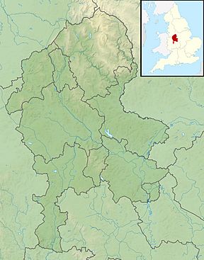
| Location | Staffordshire/Derbyshire, England |
| OS grid | SK0252969826 |
Cheeks Hill is a cool hill located in the Peak District in England. It's found on a larger area called Axe Edge Moor. This hill sits just south of a well-known road called the Cat and Fiddle Road, not far from the town of Buxton.
Cheeks Hill is special because it forms part of the border between two English counties: Derbyshire and Staffordshire. The very highest point in Staffordshire, which is about 520 meters (or 1,706 feet) above Sea level, is actually found just southwest of Cheeks Hill's top.
Exploring Cheeks Hill
When you visit Cheeks Hill, you'll find some interesting features. Just southwest of the very top, there's a long dry stone wall. This wall is built from stones without any cement and clearly marks the border between Staffordshire and Derbyshire.
What You'll See
On the Staffordshire side of the hill, there's an old, unused quarry. A quarry is a place where rocks or minerals were once dug out of the ground. There's also a shaft, which is like a deep hole.
On the Derbyshire side, you'll find a spot called Dane Head. This is where the River Dane begins its journey! Imagine, a whole river starting right there.
Where Three Counties Meet
Cheeks Hill is also quite close to a famous landmark called Three Shires Head. This spot is about one mile northeast of Cheeks Hill. It's where the borders of three different counties all meet: Staffordshire, Derbyshire, and Cheshire. It's a unique place to stand!
 | Bessie Coleman |
 | Spann Watson |
 | Jill E. Brown |
 | Sherman W. White |


