Cheero Point, New South Wales facts for kids
Quick facts for kids Cheero PointCentral Coast, New South Wales |
|||||||||||||||
|---|---|---|---|---|---|---|---|---|---|---|---|---|---|---|---|
 |
|||||||||||||||
| Population | 87 (2016 census) | ||||||||||||||
| Postcode(s) | 2083 | ||||||||||||||
| Elevation | 6 m (20 ft) | ||||||||||||||
| Location | |||||||||||||||
| LGA(s) | Central Coast Council | ||||||||||||||
| Parish | Cowan | ||||||||||||||
| State electorate(s) | Gosford | ||||||||||||||
| Federal Division(s) | Robertson | ||||||||||||||
|
|||||||||||||||
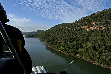
Cheero Point is a small, quiet place located right by the water. It is part of the Central Coast region in New South Wales, Australia. This area is special because it sits on the west side of Mooney Mooney Creek, inside the beautiful Brisbane Water National Park. Cheero Point is about 53 kilometers (around 33 miles) north of Sydney. It is managed by the Central Coast Council.
Contents
History of Cheero Point
How Cheero Point Began
Cheero Point was first created as a land area in 1918. For a while, in 1977, it was considered part of a nearby suburb called Mooney Mooney. However, the people living there really wanted Cheero Point to be its own place again.
Becoming Its Own Suburb
Thanks to the local community and a group called the Mooney-Cheero Progress Association, their wish came true. The local council agreed, and Cheero Point officially became its own suburb again on March 21, 2003.
The Big Landslide Story
Cheero Point became well-known because of a big landslide that happened near Jolls Bridge. This landslide caused a part of the Pacific Highway to close for several years. By March 1990, only one lane of the road was open. Then, in April 1991, the highway had to be completely closed to traffic.
This road was very important because it was the only other way to get between Gosford and Sydney besides the Pacific Motorway. A local business owner named Jim Lloyd collected 60,000 signatures from people who wanted the road reopened. Fixing the highway was estimated to cost about A$2.3 million in May 1993. The road finally reopened in June 1994. Later, in the 1996 federal elections, Jim Lloyd was elected to represent the area, which included Cheero Point.
Geography of Cheero Point
Cheero Point is surrounded by natural features. To the west, you'll find the Pacific Motorway. To the east is Mooney Mooney Creek. The northern edge of Cheero Point touches the southern boundary of the Brisbane Water National Park. The Pacific Highway also runs through this area.
Transport in Cheero Point
If you need to get around, there are about 65 buses each week. They leave from the corner of Cheero Point Road and Cararma Parkway.
 | Shirley Ann Jackson |
 | Garett Morgan |
 | J. Ernest Wilkins Jr. |
 | Elijah McCoy |


