Mooney Mooney, New South Wales facts for kids
Quick facts for kids Mooney MooneyCentral Coast, New South Wales |
|||||||||||||||
|---|---|---|---|---|---|---|---|---|---|---|---|---|---|---|---|

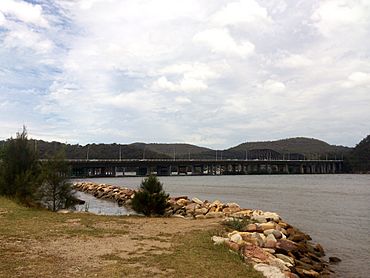
Mooney Mooney with Deerubbun Reserve in the background
|
|||||||||||||||
| Postcode(s) | 2083 | ||||||||||||||
| Elevation | 16 m (52 ft) | ||||||||||||||
| Location | |||||||||||||||
| LGA(s) | Central Coast Council | ||||||||||||||
| Parish | Cowan | ||||||||||||||
| State electorate(s) | Gosford | ||||||||||||||
| Federal Division(s) | Robertson | ||||||||||||||
|
|||||||||||||||
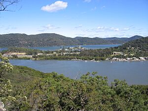
Mooney Mooney is a small village located right on the water. It's part of the Central Coast region in New South Wales, Australia. This village is about 50 kilometers (31 miles) north of Sydney. It sits on a piece of land that stretches out into the beautiful Hawkesbury River.
Mooney Mooney is also home to two islands: Peat Island and Spectacle Island. It's an important spot because the main roads, the Pacific Motorway and Pacific Highway, cross the Hawkesbury River here. This is where the Central Coast connects to the greater Sydney area.
Contents
Getting Around Mooney Mooney
Want to know how people travel in and out of Mooney Mooney?
Bus Services
A bus company called CDC NSW runs one bus route through Mooney Mooney. This bus can take you to several places:
- Route 592: From Hornsby to Brooklyn. Along the way, it stops at places like Asquith, Mount Colah, Mount Kuring-gai, and Berowra.
Mooney Mooney's Past
Mooney Mooney has an interesting history, especially when it comes to early travel in New South Wales.
Early Ferry Services
A special plaque at Deerubbun Reserve tells us that Mooney Mooney was important for early settlements. Back in 1844, a settler named George Peat started a ferry service. This ferry would carry people and goods across the Hawkesbury River. It went from Mooney Mooney Point to Kangaroo Point on the other side.
From Ferries to Bridges
By 1930, two diesel-powered ferries took over the service. However, these ferries became old-fashioned when the Peats Ferry Road Bridge was finished in 1945. You can still see some old wooden poles from the ferry docks on the Mooney Mooney Point shoreline today. They are kept there to remember the past.
About the Area
Mooney Mooney is part of the Central Coast Council area.
Islands and Neighbors
The area includes Peat Island and Spectacle Island. A nearby place called Cheero Point used to be part of Mooney Mooney. But it became its own separate area in 2003.
Landscape and What's There
Mooney Mooney has a rocky shoreline along the Hawkesbury River. The land is quite hilly, with some very steep slopes. The main features of the area are the big roads, the M1 Pacific Motorway and the Pacific Highway. There are also two neighborhoods located east of the highway.
The area has sealed roads, electricity, phone lines, and a water supply.
Deerubbun Reserve
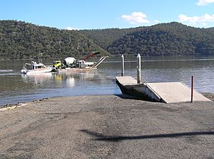
There's a public park called Deerubbun Reserve. It's about 1.93 hectares (4.77 acres) in size. This reserve is a great place for people to get to the Hawkesbury River. It has lots of facilities for visitors, including:
- A wharf and boat ramps for launching boats.
- Parking areas for cars and boat trailers.
- A fish-cleaning table.
- Signs with important information about boating, fishing, and water safety.
- Picnic tables and restrooms.
Peat Island and Spectacle Island
Peat Island is connected to the mainland by a causeway. It used to be a hospital. Now, it's managed by a government department that helps the community.
Spectacle Island is about 36.4 hectares (90 acres) in size. It's an offshore nature reserve. This means it's a protected area managed by the National Parks and Wildlife Service. They work to protect the island's natural environment.
 | Audre Lorde |
 | John Berry Meachum |
 | Ferdinand Lee Barnett |


