Cheney, Nebraska facts for kids
Quick facts for kids
Cheney, Nebraska
|
|
|---|---|
 |
|
| Country | United States |
| State | Nebraska |
| County | Lancaster |
| Area | |
| • Total | 0.14 sq mi (0.37 km2) |
| • Land | 0.14 sq mi (0.37 km2) |
| • Water | 0.00 sq mi (0.00 km2) |
| Elevation | 1,444 ft (440 m) |
| Population
(2020)
|
|
| • Total | 164 |
| • Density | 1,163.12/sq mi (448.21/km2) |
| Time zone | UTC-6 (Central (CST)) |
| • Summer (DST) | UTC-5 (CDT) |
| ZIP codes |
68526
|
| FIPS code | 31-08990 |
| GNIS feature ID | 2806911 |
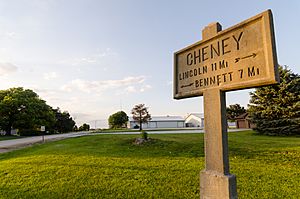
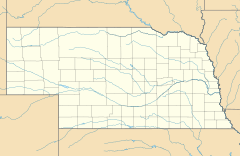
Cheney is a small, quiet community located in Lancaster County, Nebraska. It is not a big city, but an unincorporated community, meaning it doesn't have its own local government like a city does. It's a place where people live, close to the larger city of Lincoln.
A Look Back at Cheney's History
Cheney got its start because of a railroad! In 1867, the Midland Pacific Railroad was created in Nebraska City. The railroad began building a new line to Lincoln the next year. This new line went right through land owned by a person named Mr. Cheney.
In 1871, a train station was built on Mr. Cheney's land. It was named Cheney's Station. A few years later, in 1874, the village of Cheney was officially planned out. It had a unique triangle shape along the railroad tracks. That same year, the very first school was built in Cheney. A post office opened in Cheney in 1876, so people could send and receive mail.
Even though Cheney never grew very large (its biggest population was only 49 people at one point!), it had many important businesses over the years. There was a lumberyard, a grocery store, and even a dance hall! People could also find three churches, a bank, a hardware store, and a grain elevator.
Today, Cheney is very close to the city of Lincoln. Lincoln has grown a lot, and now it borders Cheney on the north and west sides. This means only the eastern part of Cheney isn't directly next to Lincoln.
Learning in Cheney
Students living in Cheney attend schools that are part of the Lincoln Public Schools system. This means they go to schools managed by the Lincoln city school district.
Who Lives in Cheney?
| Historical population | |||
|---|---|---|---|
| Census | Pop. | %± | |
| 2020 | 164 | — | |
| U.S. Decennial Census | |||
According to the 2020 census, 164 people live in Cheney. This number helps us understand how many people call this small community home.
 | Janet Taylor Pickett |
 | Synthia Saint James |
 | Howardena Pindell |
 | Faith Ringgold |


