Chevy Chase (town), Maryland facts for kids
Quick facts for kids
Town of Chevy Chase, Maryland
|
|||
|---|---|---|---|

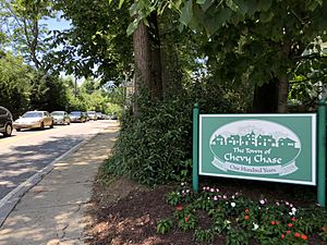
Entering the Town of Chevy Chase along MD 191 westbound
|
|||
|
|||

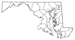
Location of Chevy Chase
|
|||
| Country | |||
| State | |||
| County | Montgomery | ||
| Incorporated | 1918 | ||
| Named for | Chevy Chase Land Company | ||
| Area | |||
| • Total | 0.47 sq mi (1.20 km2) | ||
| • Land | 0.47 sq mi (1.20 km2) | ||
| • Water | 0.00 sq mi (0.00 km2) | ||
| Elevation | 338 ft (103 m) | ||
| Population
(2020)
|
|||
| • Total | 2,904 | ||
| • Density | 6,245.16/sq mi (2,411.97/km2) | ||
| Time zone | UTC-5 (Eastern (EST)) | ||
| • Summer (DST) | UTC-4 (EDT) | ||
| ZIP Codes |
20813, 20815, 20825
|
||
| Area codes |
|
||
| FIPS code | 24-16620 | ||
| GNIS feature ID | 2390788 | ||
Chevy Chase is an official town in Montgomery County, Maryland, United States. It is also known as the Town of Chevy Chase. In 2020, about 2,904 people lived here.
The Town of Chevy Chase is part of a larger area. This bigger community is also called Chevy Chase. It includes several other nearby settlements in Montgomery County. It also includes one neighborhood in Washington, D.C..
Contents
History of Chevy Chase
How the Town Began
In the 1890s, a group of real estate developers bought over 1,700 acres of land. This land was in upper Northwest D.C. and southern Montgomery County. Their goal was to create a new suburban area.
This group was led by Francis G. Newlands. He named the new area Chevy Chase. It was designed as a "streetcar suburb." This meant people could easily travel by streetcar.
Becoming an Official Town
In 1918, a part of this development, called Section IV, became an official town. It was named the Town of Chevy Chase. This new town government could collect taxes. It could also provide important services to its residents.
Geography of Chevy Chase
Where is Chevy Chase Located?
The Town of Chevy Chase is in the southern part of Montgomery County. Its southern edge is about one mile north of Washington, D.C..
The town shares borders with other communities. To the east, it borders the villages of Chevy Chase Section Five and Chevy Chase Section Three. To the north, it borders parts of Chevy Chase that are not officially towns. To the west, it borders Bethesda. The Chevy Chase Club is located to the south of the town.
Size and Water Features
The Town of Chevy Chase covers about 0.47 square miles (1.20 square kilometers). All of this area is land.
A small stream called Coquelin Run starts in the town. This stream flows into Rock Creek.
Population Information
| Historical population | |||
|---|---|---|---|
| Census | Pop. | %± | |
| 1950 | 1,971 | — | |
| 1960 | 2,243 | 13.8% | |
| 1970 | 2,266 | 1.0% | |
| 1980 | 2,903 | 28.1% | |
| 1990 | 2,675 | −7.9% | |
| 2000 | 2,726 | 1.9% | |
| 2010 | 2,824 | 3.6% | |
| 2020 | 2,904 | 2.8% | |
| U.S. Decennial Census | |||
People Living in Chevy Chase
In 2010, there were 2,824 people living in the town. There were 1,003 households, which are groups of people living together. Most households (835) were families.
The town had about 6,008 people per square mile. Most residents (92.1%) were White. Other groups included Asian (3.9%), African American (1.0%), and Native American (0.1%). About 4.7% of the population was Hispanic or Latino.
Age and Households
About 41.5% of households had children under 18. Most households (75.0%) were married couples. The average household had 2.82 people.
The average age of people in the town was 46.3 years. About 27.5% of residents were under 18 years old. About 14.4% were 65 years or older.
Getting Around Chevy Chase
Several main roads are important for transportation in Chevy Chase. Three state highways form the town's borders. A fourth highway is very close by.
Major Roads
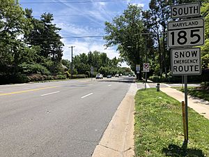
Maryland Route 185 (also called Connecticut Avenue) is a key road. It forms the eastern border of the town. MD 185 goes south into Washington, D.C.. It goes north to Interstate 495, which is a major highway known as the Capital Beltway.
Maryland Route 410 (East–West Highway) starts on the north side of town. It connects to many other suburban towns. These towns are north and northeast of Washington, D.C.
On the south side of town, Maryland Route 191 goes west. It passes through Bethesda and goes towards Potomac.
Another important road is Maryland Route 355 (Wisconsin Avenue). It is just west of the town. It offers similar connections as MD 185.
Education in Chevy Chase
Students living in the Town of Chevy Chase attend schools managed by the Montgomery County Public Schools.
Local Schools
Children in the town are assigned to specific schools based on where they live. These schools include:
- Rosemary Hills Elementary School (PreK-2)
- North Chevy Chase Elementary School
- Westbrook Elementary School
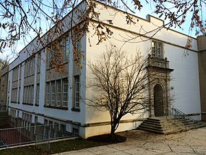
- Chevy Chase Elementary School (grades 3-6), which is located within the Town of Chevy Chase.
- Westland Middle School
- Bethesda-Chevy Chase High School
See also
 In Spanish: Chevy Chase (Maryland) para niños
 | Frances Mary Albrier |
 | Whitney Young |
 | Muhammad Ali |


