Chichester Harbour facts for kids
| Site of Special Scientific Interest | |
 |
|
| Area of Search | Hampshire West Sussex |
|---|---|
| Interest | Biological Geological |
| Area | 3,733.5 hectares (9,226 acres) |
| Notification | 1985 |
| Location map | Magic Map |
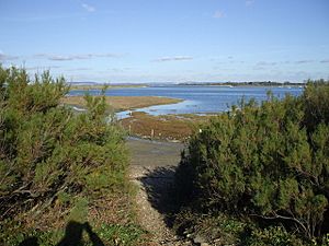
Chichester Harbour is a huge natural harbour located west of Chichester in Hampshire and West Sussex. It covers about 3,733.5 hectares (9,225 acres) of land and water. This special area is important for both its amazing wildlife and its unique geology.
It's recognized as a Site of Special Scientific Interest (SSSI). This means it's protected because of its rare plants, animals, or geological features. The harbour is also part of the Chichester Harbour Area of Outstanding Natural Beauty, which highlights its beautiful scenery.
Many parts of the harbour have even more protection. It's a Special Area of Conservation and a Special Protection Area for birds. It's also a Ramsar site, which means it's a wetland of international importance.
Contents
What is Chichester Harbour?
Chichester Harbour is a large natural harbour. It is found southwest of the city of Chichester. It is one of four natural harbours along this part of the coast. The others are Portsmouth Harbour, Langstone Harbour, and Pagham Harbour.
The harbour and its surrounding land are looked after by the Chichester Harbour Conservancy. This area is one of the few wild coastal spots left in Southern England. It has wide open spaces and many small waterways called creeks. These make it a major home for wildlife. They are also very popular for boating.
A Home for Wildlife
The harbour has huge areas of tidal flats and salt marshes. These are very important for nature. Many wildfowl and wading birds use the mudflats. They feed on the rich plant life and tiny creatures in the mud.
More than 7,500 Brent geese spend the winter here. They feed on the mud-land and nearby farms. About 55,000 birds live in or visit the harbour throughout the year. This makes it a very important place for birds.
Villages and Towns Nearby
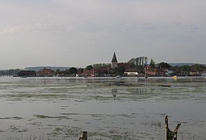
Many charming villages are located around the harbour. These include West Wittering, West Itchenor, Birdham, Dell Quay, Fishbourne, Bosham, Chidham, Prinsted, Thorney Island, Emsworth, Langstone, and Northney.
The closest towns are Havant, Chichester, and Hayling Island. The low-lying areas around the harbour have good farmland. Boatyards, marinas, and commercial fishing are also important for the local economy.
How the Harbour is Managed
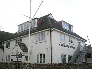
The Chichester Harbour Conservancy was set up in 1971. Its job is to protect, care for, and improve the harbour. This includes looking after it for fun activities, nature, and its natural beauty. The Conservancy also manages the Area of Outstanding Natural Beauty (AONB).
Harbour Channels
Chichester Harbour has three main channels. These are like natural waterways. They are the Emsworth Channel, the Thorney Channel, and the Chichester Channel. The Chichester Channel also has branches called Bosham Lake and Itchenor Reach.
Nature and Geology
The harbour has many different types of natural areas. These include mudflats that are covered and uncovered by tides. There are also shingle beaches, salt marshes, sand dunes, and woodlands.
The mudflats are important feeding places for many birds. These include ringed plovers, grey plovers, redshanks, black-tailed godwits, dunlins, sanderlings, curlews, and greenshanks. There are also important sand dunes and shingle areas at East Head and near Langstone.
Fun Activities at the Harbour
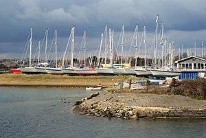
Chichester Harbour is a very popular place for many water sports. People enjoy all kinds of sailing here. This includes dinghy racing. There are also several yacht marinas where boats can be kept. Fishing is another popular activity.
Boat Trips
You can take boat tours from Itchenor all year round. You can ride in a traditional boat or on Solar Heritage. This is a special boat powered by the sun! In the summer, you can also take trips from Emsworth. These are on Solar Heritage or on Terror, a Victorian oyster boat.
There is also a small ferry service. It uses a dory boat to take people between Itchenor and Bosham.
Birdwatching and Walking
The harbour is a great place for birdwatching. The Chichester Harbour Conservancy offers guided bird walks and boat trips in the winter. This helps people see the many birds that visit.
There are also many footpaths for walkers to enjoy. A cycle route goes from Chichester to West Wittering. It passes through the beautiful countryside around the harbour.
West Wittering Beach
West Wittering Beach and East Head is the only sandy beach on the West Sussex coast. It is a very popular place for families and tourists. Many people visit on warm weekends to enjoy the sand and sea.
 | Valerie Thomas |
 | Frederick McKinley Jones |
 | George Edward Alcorn Jr. |
 | Thomas Mensah |


