Chichester to Silchester Way facts for kids
The Chichester to Silchester Way was an important Roman road in Britain. It connected two major Roman towns: Chichester, known as Noviomagus, the capital of the Regnenses people, and Silchester, or Calleva Atrebatum, the capital of the Atrebates people. For many centuries, this road was completely lost and forgotten. There were no Anglo-Saxon place names left behind to hint at its path. It was only found by chance in 1949, thanks to aerial photography. Today, only about 6 kilometres (3.7 mi) (about 4 miles) of the original 62 kilometres (39 mi) (about 38.5 miles) road are still used.
Contents
How the Road Was Found
People didn't know this Roman road existed until 1949. That year, a team from the Ordnance Survey (a mapping agency) was looking at aerial photographs of the Milland area. They noticed some old earthworks – shapes in the ground – that looked like a Roman mansio. A mansio was like a roadside inn or rest stop for travelers. These earthworks were similar to other known mansio sites on another Roman road called Stane Street.
Because this mansio was on the shortest part of the road's path, it didn't give many clues about the whole route. It took a lot more looking at aerial photos and checking the ground to figure out where the entire road went.
Building the Roman Road
The Romans were clever engineers! Building a straight road between Chichester and Silchester would have meant crossing many small rivers and streams, including the River Rother twice. So, the Romans chose a slightly different path. They used four straight sections that connected together. This route crossed the River Rother only once, near Iping. It also joined another Roman road (from Winchester to Silchester) about a mile south of Silchester, which helped them avoid two more river crossings near that town.
This road was wider than most Roman roads in Britain and was built very well. It had a layer of flint or gravel on top of a raised, curved foundation called an agger. An excavation (dig) at Milland showed that the road had a 2 to 3-inch (about 5-7.5 cm) layer of gravel over a strong, curved base.
The Road's Journey
From Chichester to Dunner Hill
The road starts from the north gate of Chichester (50°50′24″N 0°46′44″W / 50.840°N 0.779°W). It seems to point directly towards Silchester. We don't know if this was planned or if it followed an older path from the Iron Age that just happened to go in that direction.
Near East Broyle Copse, the road turns north towards Dunner Hill. It follows or runs close to Brandy Hole Lane and passes west of Lavant House School. Part of Two Barns Lane also runs on top of the old road. As it goes up to Heathbarn Down, you can sometimes see old hedgerows (lines of bushes) that follow the road's path. On the open down, the raised agger (road foundation) can be seen from the air and on the ground, with ditches about 60 feet (18 meters) apart on either side.
Further along, a slight agger is visible on Stapleash Down. Then, it becomes a terraceway (a flat path cut into a hillside) as it goes down the hill. It passes east of Staple Ash Farm and enters a wood called "The Ditches." Here, you can see it as a wide agger (up to 30 feet or 9 meters wide) with lots of flint stones. In Linchball Wood, the road curves slightly east, just inside the western edge of the wood. It reaches its highest point at 217 metres (712 ft) (about 712 feet). From here, you get amazing views north over the Western Weald and south towards Chichester and the coast.
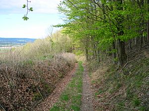
After crossing the South Downs Way (a modern walking path), the road goes down the steep scarp slope of Linch Down. It looks like an eroded terraceway. Lower down, it becomes a deep hollow way (a path worn down by centuries of use) as it descends to Linch Farm. From here, a farm track follows the road for about 500 meters before it disappears into fields. The road can be found again along the west side of Haccott's Copse. It then passes east of Fitzhall to Fitzhall Heath, where it goes between ancient burial mounds (tumuli) as a clear agger.
The road continues across Iping Common as an agger with ditches 60 feet apart, then as a hollow. It crosses the A272 road and then runs as a slight terrace along the west edge of Crowshole Copse to the River Rother. North of the river, the road crosses open fields. A hedge then follows its line north of Hammer Lane. An agger is visible in Captain's Wood before Iping Lane briefly follows it at Stubbhill Farm. Finally, the road follows a terraceway up Dunner Hill, then goes down in a zig-zag pattern.
From Dunner Hill to Weavers Down
After zig-zagging down Dunner Hill, the next straight section towards Weavers Down begins. You can see traces of the agger across Iping Marsh, leading to the mansio (Roman inn) site at Weston's Farm. This mansio was a bit smaller than the ones found on Stane Street.
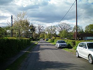
The road is still used today through the village of Milland. After Milland, the exact path becomes unclear for a bit. It can then be found as a cutting (a path dug into the ground) and then a large causeway (a raised road over wet ground) at Chapel Common. Passing southwest of Hutfield Copse, the road crosses the Sussex Border Path and soon enters the army training area at Weavers Down. Here, you can see traces of an agger with side ditches going up to the top of the hill. It crosses the hilltop as an eroded terrace.
From Weavers Down to Silchester
The road becomes the main track of Longmoor Military Camp. North of the A3 road, it passes west of Woolmer Pond near Greatham. It changes direction slightly as it crosses the A325 road. It then goes through the western edge of Blackmoor and continues northwest through Binswood. It crosses the B 3004 road east of East Worldham, then crosses Wyck Lane not far from where a Roman building once stood near Wyck Place. The road passes through Upton Grey, east of Old Basing, then through Bramley, before finally joining the Winchester to Silchester road (51°21′14″N 1°06′00″W / 51.354°N 1.1°W).
Interesting Facts
In the area of East Hampshire, this Roman road passed through a region where Romans grew grapes for wine! It was also close to Alice Holt Forest. In Roman times, pottery was made here on a very large scale, almost like a factory. Pottery from Alice Holt has been found all along the coast of Sussex and Hampshire, showing how far it was traded.
 | Shirley Ann Jackson |
 | Garett Morgan |
 | J. Ernest Wilkins Jr. |
 | Elijah McCoy |


