Chico, Washington facts for kids
Quick facts for kids
Chico, Washington
|
|
|---|---|
| Country | United States |
| State | Washington |
| County | Kitsap |
| Area | |
| • Total | 2.29 sq mi (5.93 km2) |
| • Land | 2.29 sq mi (5.93 km2) |
| • Water | 0 sq mi (0.0 km2) |
| Elevation | 40 ft (10 m) |
| Population
(2020)
|
|
| • Total | 2,723 |
| • Density | 1,189.3/sq mi (459.2/km2) |
| Time zone | UTC-8 (Pacific (PST)) |
| • Summer (DST) | UTC-7 (PDT) |
| ZIP code |
98312
|
| Area code(s) | 360 |
| FIPS code | 53-12175 |
| GNIS feature ID | 1512090 |
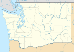
Chico is a small community in Kitsap County, Washington, United States. It's not a city with its own government. Instead, it's called a "census-designated place" (CDP). This means it's an area that the government counts for population statistics.
Chico got its name in 1889. It was named after a local Native American person. The community is located right on the water, next to Dyes Inlet. This is a beautiful area south of Silverdale. In 2020, about 2,723 people lived in Chico.
| Historical population | |||
|---|---|---|---|
| Census | Pop. | %± | |
| 2010 | 2,259 | — | |
| 2020 | 2,723 | 20.5% | |
| Sources: | |||
Contents
Chico's Location and Surroundings
Chico is in the middle part of Kitsap County. It has different neighbors on each side. To the north, you'll find Silverdale. To the south are the communities of Erlands Point and Kitsap Lake.
Waterways and Natural Features
To the east, Chico is next to Dyes Inlet. This is a body of water that connects to Puget Sound. Puget Sound is a large inlet of the Pacific Ocean. Water flows from Dyes Inlet through Port Washington Narrows near Bremerton. Then it goes through the strait of Port Orchard to reach the wider Puget Sound.
On the west side of Chico, there's Camp Wesley Harris and Newberry Hill Heritage Park. These areas offer natural spaces.
Roads and Boundaries
Newberry Hill Road forms the northern edge of Chico, separating it from Silverdale. Chico Creek creates the southern boundary. This creek flows between Chico and the communities of Erlands Point and Kitsap Lake.
Washington State Route 3 is a main road that goes through Chico. If you drive north on this road, you'll reach Port Gamble in about 19 miles. Driving south for about 4 miles will take you to the western side of Bremerton.
Land Area
The U.S. Census Bureau keeps track of land areas. They say that the Chico CDP covers about 5.9 square kilometers. All of this area is land, with no water within its official boundaries.
See also
 In Spanish: Chico (Washington) para niños
 | Ernest Everett Just |
 | Mary Jackson |
 | Emmett Chappelle |
 | Marie Maynard Daly |


