Chiloé Province facts for kids
Quick facts for kids
Chiloé Province
Provincia de Chiloé
|
|||
|---|---|---|---|
|
|||

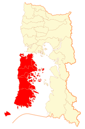
Location in the Los Lagos Region
|
|||
| Country | |||
| Region | |||
| Capital | Castro |
||
| Communes | |||
| Government | |||
| • Type | Provincial | ||
| Area | |||
| • Total | 7,165.5 km2 (2,766.6 sq mi) | ||
| Population
(2012 Census)
|
|||
| • Total | 161,654 | ||
| • Density | 22.56004/km2 (58.4302/sq mi) | ||
| • Urban | 82,058 | ||
| • Rural | 60,136 | ||
| Sex | |||
| • Men | 71,386 | ||
| • Women | 70,808 | ||
| Time zone | UTC-4 (CLT) | ||
| • Summer (DST) | UTC-3 (CLST) | ||
| Area code(s) | +56-65 | ||
Chiloé Province (which is called Provincia de Chiloé in Spanish) is a special part of Chile. It's one of four provinces in the southern Los Lagos area. This province includes almost all of the Chiloé Archipelago, which is a group of islands. The main island is Chiloé Island.
The province covers a large area of about 9,181.6 square kilometers (3,545 square miles). Its main city and capital is Castro. Another important city is Ancud, which is where the main church leader (bishop) for the area is located.
Contents
How Chiloé Province Is Governed
Chiloé is a "province," which means it's a second-level administrative division in Chile. Think of it like a state or a large county. It is managed by a governor. This governor is chosen by the President of Chile.
Cities and Towns in Chiloé
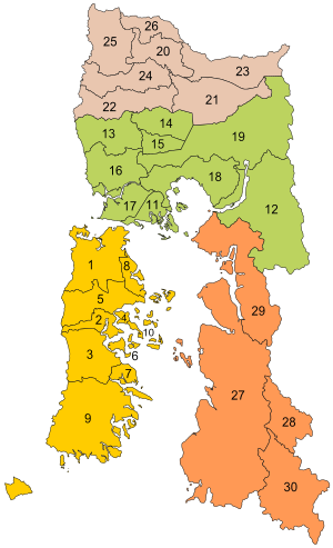
Chiloé Province is made up of ten smaller areas called "communes." Each commune has its own local government. This government includes an alcalde (like a mayor) and a municipal council (a group of local leaders).
Here are the ten communes in Chiloé Province:
| Commune | Seal | Population (2017) |
|---|---|---|
| 1. Ancud | 38 991 | |
| 2. Castro | 43 807 | |
| 3. Chonchi | 14 858 | |
| 4. Curaco de Vélez | 3 829 | |
| 5. Dalcahue | 13 762 | |
| 6. Puqueldón | 3 921 | |
| 7. Queilén | 5 385 | |
| 8. Quemchi | 8 352 | |
| 9. Quellón | 27 192 | |
| 10. Quinchao | 8 088 |
Land and People of Chiloé
In 2002, the National Statistics Institute in Chile counted the people living in Chiloé. They found that the province covers about 7,165.5 square kilometers (2,766.6 square miles). At that time, 142,194 people lived there. This included 71,386 men and 70,808 women.
More than half of the people (about 57.7%) lived in cities and towns. The rest (about 42.3%) lived in the countryside. Between 1992 and 2002, the number of people living in Chiloé grew by about 9.1%.
See also
 In Spanish: Provincia de Chiloé para niños
 | Janet Taylor Pickett |
 | Synthia Saint James |
 | Howardena Pindell |
 | Faith Ringgold |


