
Chipaque facts for kids
Quick facts for kids
Chipaque
|
|||
|---|---|---|---|
|
Municipality and town
|
|||

Church of Chipaque
|
|||
|
|||

Location of Chipaque inside Cundinamarca, Colombia
|
|||

Chipaque
Location in Colombia
|
|||
| Country | |||
| Department | |||
| Province | Eastern Province | ||
| Founded | 2 October 1600 | ||
| Founded by | Luis Enríquez | ||
| Area | |||
| • Municipality and town | 139.45 km2 (53.84 sq mi) | ||
| • Urban | 2.1 km2 (0.8 sq mi) | ||
| Elevation | 2,400 m (7,900 ft) | ||
| Population
(2015)
|
|||
| • Municipality and town | 8,400 | ||
| • Density | 60.2/km2 (156.0/sq mi) | ||
| • Urban | 2,530 | ||
| Time zone | UTC-5 (Colombia Standard Time) | ||
.svg)

Chipaque is a town and a municipality (like a county) in the Cundinamarca region of Colombia. It covers about 139 square kilometers (54 square miles). Chipaque is high up in the Andes mountains, about 2,400 meters (7,874 feet) above sea level. It's also near the Eastern Hills of Bogotá.
The capital city of Colombia, Bogotá, is only about 27 kilometers (17 miles) west of Chipaque. Chipaque shares borders with Usme (a part of Bogotá) to the west. To the east, it borders Cáqueza. To the south is Une, and to the north is Ubaque. The average temperature in Chipaque is around 13°C (55°F).
Contents
What Does "Chipaque" Mean?
The name Chipaque comes from an old word, Chipapabacue. This word is from the Muysccubun language, spoken by the Muisca people. It means "Forest of our ancestors."
Symbols of Chipaque
Chipaque has its own flag and seal, which are important symbols for the town.
The Flag of Chipaque
The flag has two equal stripes. One stripe is yellow, and the other is green. Yellow stands for wealth and richness. Green represents hope and also shows the area's fertile land. A white triangle starts from the side of the flag where the pole is. Its points meet in the middle, where the yellow and green stripes join.
The Seal of Chipaque
The seal is an emblem framed by the flags of Colombia and Cundinamarca. Their flagpoles cross each other. A yellow ribbon is wrapped around the crossed flagpoles, with the name "Chipaque" written on it. At the bottom of the seal, you can see a typical landscape of the region and the sun.
The Land and Rocks of Chipaque
Chipaque is known for a special type of rock formation.
Chipaque Formation
The Chipaque Formation is a layer of rocks named after this area. It's made up of dark, organic shales and layers of sandstone. These rocks can tell us a lot about the Earth's history.
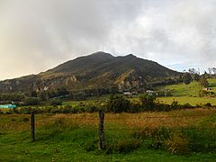
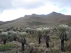
Páramo de Cruz Verde
The Páramo de Cruz Verde is a unique high-altitude ecosystem. It's located in the northern part of the municipality. Páramos are very important for water regulation and have special plants.
A Look Back: History of Chipaque
Chipaque has a rich history, dating back to before European settlers arrived.
Early Inhabitants: The Muisca People
Before the Spanish arrived, the area of Chipaque was home to the Muisca. They were an indigenous group in Colombia. The Muisca lived in a loose group of communities called the Muisca Confederation. Chipaque was part of a larger area ruled by a leader called a cacique from Ubaque.
Spanish Arrival and Founding
During the time of the Spanish conquest, a main Spanish leader named Gonzalo Jiménez de Quesada sent a person named Juan Tafur to explore eastward. In 1538, Juan Tafur set up the first church in Chipaque. Modern Chipaque was officially founded on October 2, 1600, by a person named Luis Enríquez.
How Chipaque Makes a Living: Economy
The main ways people in Chipaque earn money are through farming and raising animals.
Farming in Chipaque
Agriculture (farming) is very important here. The most important crops grown are potatoes, which make up about 45% of the farm products. Onions are also a big crop, making up about 25%.
Raising Livestock
Livestock farming, which means raising animals like cows, is another key activity in Chipaque.
Gallery
-
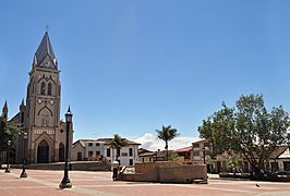
Central square
-
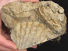
Oyster fossils in the Chipaque Formation


-
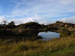
Páramo de Cruz Verde
-
Páramo de Cruz Verde
-
Páramo de Cruz Verde


See also
 In Spanish: Chipaque para niños
