Christopher Creek, Arizona facts for kids
Quick facts for kids
Christopher Creek, Arizona
|
|
|---|---|
 |
|

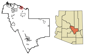
Location of Christopher Creek in Gila County, Arizona.
|
|
| Country | |
| State | |
| County | Gila |
| Area | |
| • Total | 3.14 sq mi (8.13 km2) |
| • Land | 3.14 sq mi (8.13 km2) |
| • Water | 0.00 sq mi (0.00 km2) |
| Elevation | 5,961 ft (1,817 m) |
| Population
(2020)
|
|
| • Total | 121 |
| • Density | 38.55/sq mi (14.88/km2) |
| Time zone | UTC−7 (MST) |
| • Summer (DST) | UTC−7 (no DST/PDT) |
| ZIP code |
85541
|
| Area code(s) | 928 |
| FIPS code | 04-13140 |
| GNIS ID(s) | 2582755 |
Christopher Creek is a small community in Gila County, Arizona. It is known as a census-designated place, which means it's a special area counted by the census.
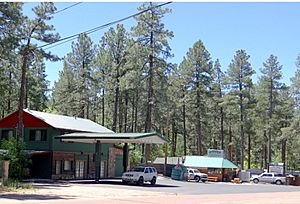
This community sits at the bottom of the Mogollon Rim, a huge cliff. It's about 5,961 feet (1,817 meters) above sea level. Christopher Creek is located about 23.5 miles (37.82 km) northeast of Payson, right off SR 260. In 2020, about 121 people lived here.
What People Do in Christopher Creek
The main ways people make a living in Christopher Creek are through tourism, retirement, and timbering (cutting down trees for wood). Many visitors come to enjoy the beautiful nature.
How Many People Live Here?
Christopher Creek is a small place. Here's how its population has changed over time:
| Historical population | |||
|---|---|---|---|
| Census | Pop. | %± | |
| 2020 | 121 | — | |
| U.S. Decennial Census | |||
Getting Around
If you need to travel to or from Christopher Creek without a car, the Mountain Valley Shuttle can help. It stops in Christopher Creek as part of its route between Phoenix and Show Low.
See also
 In Spanish: Christopher Creek para niños


