
Cienega Springs, Arizona facts for kids
Quick facts for kids
Cienega Springs, Arizona
|
|
|---|---|

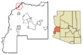
Location of Cienega Springs in La Paz County, Arizona
|
|

Cienega Springs, Arizona
Location in Arizona

Cienega Springs, Arizona
Location in the United States
|
|
| Country | United States |
| State | Arizona |
| County | La Paz |
| Area | |
| • Total | 3.85 sq mi (9.98 km2) |
| • Land | 3.55 sq mi (9.19 km2) |
| • Water | 0.30 sq mi (0.79 km2) |
| Elevation | 374 ft (114 m) |
| Population
(2020)
|
|
| • Total | 1,690 |
| • Density | 476.19/sq mi (183.88/km2) |
| Time zone | UTC-7 (Mountain (MST)) |
| ZIP code |
85344
|
| Area code(s) | 928 |
| GNIS feature ID | 24372 |
| FIPS code | 04-13540 |
Cienega Springs is a small community located in La Paz County, Arizona, in the United States. It is known as a census-designated place, which means it's an area identified by the U.S. Census Bureau for statistical purposes. In 2020, about 1,690 people called Cienega Springs home.
Contents
Exploring Cienega Springs' Location
Cienega Springs is found in the northwestern part of La Paz County. It sits right next to the famous Colorado River. This river forms a natural border for the community.
Where is Cienega Springs Located?
To the southwest, Cienega Springs shares a border with the community of Bluewater. If you look across the Colorado River to the northwest, you'll find the state of California.
Highways and Nearby Towns
Arizona State Route 95 runs along the southeastern edge of Cienega Springs. This highway is important for getting around. If you travel southwest on Route 95 for about 4.5 miles (7.2 km), you'll reach Parker. Parker is the main town and the "county seat" for La Paz County, which means it's where the county government offices are.
If you head northeast on the highway for about 11 miles (17.7 km), you'll arrive at Parker Dam. This dam is built on the Colorado River and helps create Lake Havasu, a popular spot for water activities.
How Big is Cienega Springs?
The U.S. Census Bureau measures the size of places like Cienega Springs. The total area of Cienega Springs is about 3.85 square miles (9.96 square kilometers). Most of this area, about 3.55 square miles (9.17 square kilometers), is land. The rest, about 0.30 square miles (0.79 square kilometers) or 7.9% of the total, is water, mainly from the Colorado River.
Community Services
Living in Cienega Springs means having access to important services. The Cienga Water Company provides water to the homes and businesses in the area. This helps make sure everyone has clean water for their daily needs.
Images for kids
-
Location of Cienega Springs in La Paz County, Arizona
See also
 In Spanish: Ciénega Springs para niños
