
Cispus River facts for kids
Quick facts for kids Cispus River |
|
|---|---|
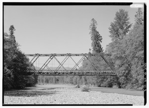
Bridge at Forest Service Road 2306
|
|


Location of the mouth of the Cispus River in Washington
|
|
| Country | United States |
| State | Washington |
| County | Lewis, Skamania |
| Physical characteristics | |
| Main source | Goat Rocks Wilderness Cascade Range 46°29′41″N 121°25′45″W / 46.49472°N 121.42917°W |
| River mouth | Cowlitz River Lake Scanewa 833 ft (254 m) 46°28′35″N 122°5′39″W / 46.47639°N 122.09417°W |
| Length | 54 mi (87 km) |
The Cispus River is a beautiful river in Washington. It is about 54 miles (87 km) long. The river flows into the Cowlitz River at a place called Lake Scanewa. The Cispus River helps drain water from parts of Lewis County, Skamania County, and Yakima County.
Contents
Where the Cispus River Starts
The Cispus River begins in Lewis County. It starts in a high valley formed by glaciers. This area is part of the Goat Rocks Wilderness. It is also inside the Gifford Pinchot National Forest. From its start, the river flows southwest. It collects water from smaller streams like Walupt Creek.
Muddy Fork and Forest Fires
About 40 miles (64 km) before it ends, the Cispus River meets a stream called Muddy Fork. Muddy Fork starts near Mount Adams. It gets its name because the water looks muddy. This is due to tiny bits of rock and dirt from the glacier.
The Cispus River flows through a valley with lots of trees. Much of this forest grew back after a big fire. This fire, called the Cispus Burn, happened early in the 1900s. It burned most of the lower part of the river's area.
Journey Through the Forest
Further along, Canyon Creek rushes into the Cispus River. This creek also starts high up on Mount Adams. A few miles later, the North Fork Cispus joins the main river. This is about 20 miles (32 km) from where the Cispus River begins.
From here, the Cispus River flows west. It passes by many campgrounds and hiking trails. These are all located in the Gifford Pinchot National Forest. Two other streams, Yellowjacket and McCoy Creeks, flow into the river from the south.
The river then goes past a tall rock called Tower Rock. This is a famous rock formation on the south side of the river. Soon after this, the river leaves the national forest. It then enters the Weyerhaeuser Cowlitz Tree Farm.
The River's End
The Cispus River finishes its journey by flowing into the Cowlitz River. This happens at Lake Scanewa. This spot is just upstream from Cowlitz Falls and Riffe Lake.
Fun on the River
The Cispus River is a great place for outdoor activities. There is a special station on the river. It sends live information about the river's flow to the United States Geological Survey (USGS). This helps people know how fast the water is moving.
Many people also enjoy whitewater rafting on the Cispus River. It's an exciting way to experience the river's rapids!
