Clackamas, Oregon facts for kids
Quick facts for kids
Clackamas, Oregon
|
|
|---|---|
|
Former Census-designated place (CDP)
|
|

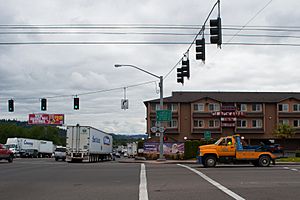
Route 212 and SE 82nd Dr. in Clackamas, Oregon
|
|
| Country | United States |
| State | Oregon |
| County | Clackamas |
| Area | |
| • Total | 2.18 sq mi (5.65 km2) |
| • Land | 2.18 sq mi (5.65 km2) |
| • Water | 0.0 sq mi (0.0 km2) |
| Elevation | 121 ft (37 m) |
| Population
(2010)
|
|
| • Total | 6,965 |
| • Density | 3,195.0/sq mi (1,232.7/km2) |
| Time zone | UTC-8 (Pacific (PST)) |
| • Summer (DST) | UTC-7 (PDT) |
| ZIP code |
97015
|
| Area code(s) | 503 |
| FIPS code | 41-13450 |
| GNIS feature ID | 2407626 |
Clackamas (pronounced CLAK-uh-muss) is a community in Clackamas County, Oregon, United States. It's a suburb of Portland. About 7,000 people lived there in 2010.
Clackamas is home to Camp Withycombe, which is a military base. It also has a branch of the Kaiser Permanente Hospital.
Contents
Geography of Clackamas
Clackamas is part of the larger Portland Metropolitan Area. It is about 10 miles (16 km) southeast of downtown Portland. You can find it east of Interstate 205. It is also near Oregon Routes 212 and 224. The Clackamas River flows to the north of the community.
The area of Clackamas is about 2.1 square miles (5.65 square kilometers). All of this area is land.
People of Clackamas
In the year 2000, there were 5,177 people living in Clackamas. These people lived in 2,000 households. About 1,336 of these were families.
Many different people live in Clackamas. The community is home to people from various backgrounds. About 36% of households had children under 18 living with them. Many families were married couples. Some households were led by a single parent.
The population in Clackamas was spread out by age. About 27% of the people were under 18 years old. Many adults were between 25 and 44 years old. About 6.5% of the people were 65 years or older. The average age in Clackamas was 33 years.
Education in Clackamas
Students in Clackamas attend schools in the North Clackamas School District. The main high school for the area is Clackamas High School. It is one of three high schools in the district.
 |
Sunnyside, Happy Valley |  |
||
| Milwaukie, Oatfield, Johnson City | Damascus, Boring | |||
| Gladstone, Oregon City |
Getting Around Clackamas
Highways
Several important roads pass through Clackamas. These include Oregon Routes 212, 213, and 224. The major highway Interstate 205 also goes through the community.
Public Transportation
Clackamas has public transportation options. There are several TriMet bus lines that serve the area. You can also use the MAX Light Rail Green Line to get around.
Air Travel
Clackamas does not have its own public airport. However, Portland International Airport (PDX) is about 15 miles (24 km) north. This airport offers many flights for travel.
See also
 In Spanish: Clackamas para niños


