Happy Valley, Oregon facts for kids
Quick facts for kids
Happy Valley, Oregon
|
|
|---|---|

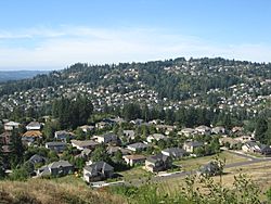
Happy Valley, on the southeast flank of Mount Scott
|
|

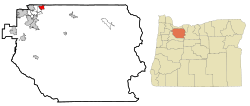
Location in Oregon
|
|
| Country | United States |
| State | Oregon |
| County | Clackamas |
| Incorporated | 1965 |
| Area | |
| • Total | 11.65 sq mi (30.17 km2) |
| • Land | 11.60 sq mi (30.04 km2) |
| • Water | 0.05 sq mi (0.12 km2) |
| Elevation | 643 ft (196 m) |
| Population
(2020)
|
|
| • Total | 23,733 |
| • Estimate
(2022)
|
26,456 |
| • Density | 2,046.12/sq mi (789.99/km2) |
| Time zone | UTC-8 (Pacific (PST)) |
| • Summer (DST) | UTC-7 (PDT) |
| ZIP code |
97086
|
| Area code(s) | 503 and 971 |
| FIPS code | 41-32050 |
| GNIS feature ID | 2410698 |
Happy Valley is a city in Oregon, USA. It is a suburb located near Portland, Oregon. Happy Valley is about 10 miles southeast of downtown Portland. In 2020, about 23,733 people lived there. It is part of the larger Portland, Oregon metropolitan area.
Contents
The Story of Happy Valley
Happy Valley was first settled by Christian and Matilda Deardorff. They received 640 acres of land in 1850. This land was located between a volcano called Mount Scott and a hill named Scouters' Mountain. The area was known by names like Deardorff Valley or Christilla Valley. The name "Christilla" came from combining "Chris" from Christian and "Tilla" from Matilda.
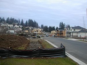
The city officially became a city in 1965. For many years, it stayed a small community. However, in the late 1990s, Happy Valley began to grow very quickly. It became one of the fastest-growing cities in all of Oregon.
Happy Valley's Location and Landscape
Happy Valley is part of the Portland, Oregon metropolitan area. It covers about 8.32 square miles (21.55 square kilometers). Most of this area is land, with a small amount of water. Happy Valley shares its borders with several other places. These include Portland, Clackamas, Damascus, Pleasant Valley, and Sunnyside.
Mountains and Hills
Mount Scott is the highest point in Happy Valley. It is an extinct volcano. This means it is a volcano that is no longer active. Mount Scott is about 1,050 feet (320 meters) tall. Another important hill in the area is Scouters Mountain.
Weather in Happy Valley
Happy Valley gets a lot of rain. It is known for its wet weather, like much of the Portland area. On average, it receives about 48 inches (122 cm) of rain each year.
Who Lives in Happy Valley
| Historical population | |||
|---|---|---|---|
| Census | Pop. | %± | |
| 1970 | 1,392 | — | |
| 1980 | 1,499 | 7.7% | |
| 1990 | 1,519 | 1.3% | |
| 2000 | 4,519 | 197.5% | |
| 2010 | 13,903 | 207.7% | |
| 2020 | 23,733 | 70.7% | |
| 2022 (est.) | 26,456 | 90.3% | |
| U.S. Decennial Census 2020 Census |
|||
Population in 2010
In 2010, there were 13,903 people living in Happy Valley. These people lived in 4,408 households. A household is a group of people living together. There were also 3,724 families. The city had about 1,679 people per square mile (648 people per square kilometer).
Most people in Happy Valley were White (76.2%). About 17.4% were Asian. Other groups included African American (1.1%) and Native American (0.5%). Some people were from two or more ethnic backgrounds (3.8%). About 4.0% of the population was Hispanic or Latino.
Many households had children under 18 living with them (48.8%). Most households were married couples (74.4%). The average household had 3.15 people. The average family had 3.40 people.
The average age in Happy Valley was 37 years old. About 30.2% of residents were under 18. About 8.2% were 65 years or older. The population was almost evenly split between males (49.7%) and females (50.3%).
Schools in Happy Valley
The North Clackamas School District serves Happy Valley. This district includes two high schools for older students. There are also two middle schools. For younger students, there are eight elementary schools.
Famous People from Happy Valley
- Lori Chavez-DeRemer, an American politician.
- Hailey Kilgore, an actress.
- Bill Sizemore, an American politician.
- Nigel Williams-Goss, a professional basketball player from America.
See also
 In Spanish: Happy Valley (Oregón) para niños
 | Precious Adams |
 | Lauren Anderson |
 | Janet Collins |


