Clairview facts for kids
Quick facts for kids ClairviewQueensland |
|||||||||||||||
|---|---|---|---|---|---|---|---|---|---|---|---|---|---|---|---|

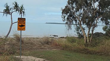
Shark sighting sign on Clairview's beach, 2016
|
|||||||||||||||
| Population | 167 (2021 census) | ||||||||||||||
| • Density | 0.9581/km2 (2.481/sq mi) | ||||||||||||||
| Postcode(s) | 4741 | ||||||||||||||
| Area | 174.3 km2 (67.3 sq mi) | ||||||||||||||
| Time zone | AEST (UTC+10:00) | ||||||||||||||
| Location | |||||||||||||||
| LGA(s) | Isaac Region | ||||||||||||||
| State electorate(s) | Mirani | ||||||||||||||
| Federal Division(s) | Capricornia | ||||||||||||||
|
|||||||||||||||
Clairview is a small coastal town in Queensland, Australia. It is part of the Isaac Region. In 2021, about 167 people lived in Clairview. It's known for its beautiful beach and being a great spot for fishing.
Contents
Exploring Clairview's Location
Clairview is right on the coast. It has a natural sandy beach. Most of the area is hilly, with some parts reaching up to 500 metres (1,600 feet) high. The flat areas near the coast are used for farming animals. The town itself is a strip of houses right by the sea.
How to Get to Clairview
The main road, the Bruce Highway, goes right through Clairview. This highway connects Brisbane to Cairns. Clairview is one of the few places where you can see the ocean from the highway! A railway line, the North Coast railway line, also runs near the highway. It has a station called Elalie, which serves the area.
Flaggy Rock Neighbourhood
In the northern part of Clairview, there's a small area called Flaggy Rock. It's located between the highway and the railway line.
A Look at Clairview's Past
Clairview got its name from an old farm called a pastoral station. It was run by W. and M. Christian a long time ago.
Old Railway Stations
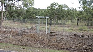
Clairview used to have its own railway station, but it's now closed. The Flaggy Rock area also had a station, first called Yokolgy or Yankolgy, then renamed Flaggy Rock railway station in 1921. It is also closed now.
Flaggy Rock Creek School
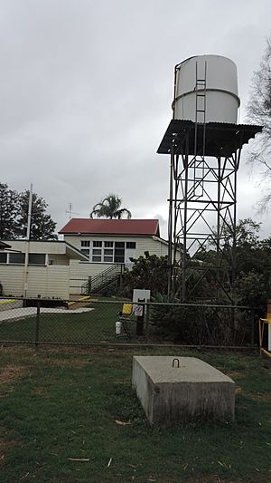
A school called Rocky Dam State School opened in Flaggy Rock in 1916. It was later renamed Flaggy Rock Creek State School. This school closed in 1996. Today, the old school building is used as the Flaggy Rock Community Centre, a place for local events.
Who Lives in Clairview?
The number of people living in Clairview has slowly grown over the years:
- In 2006, there were 75 people.
- In 2016, the population grew to 145 people.
- By 2021, 167 people called Clairview home.
Learning in Clairview
Clairview does not have its own schools.
- For primary school, kids usually go to Carmila State School (north) or St Lawrence State School (south).
- The closest high school is Sarina State High School. However, it's quite a long way to travel every day.
- Because of the distance, some students might learn through distance education (learning from home) or go to boarding schools.
Fun Things to Do in Clairview
Clairview is a popular spot for outdoor activities.
- Fishing and Crabbing: Many people come here to fish and catch mud crabs.
- Dugong Protection: The waters near Clairview are a special protected area for dugongs. These gentle sea animals are endangered, so it's important to keep their habitat safe.
- Caravan Park: There is a caravan park where visitors can stay.
- Boat Ramp: If you have a boat, there's a public boat ramp at Colonial Drive. You can launch your boat right into the Coral Sea from Clairview Beach.
 | Jessica Watkins |
 | Robert Henry Lawrence Jr. |
 | Mae Jemison |
 | Sian Proctor |
 | Guion Bluford |


