Clarks Knob facts for kids
Quick facts for kids Clarks Knob |
|
|---|---|

Clarks Knob
|
|
| Highest point | |
| Elevation | 2,316 ft (706 m) NAVD 88 |
| Geography | |
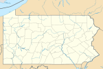
| Location | Franklin County, Pennsylvania, U.S. |
| Parent range | Blue Mountain |
| Topo map | USGS Roxbury (PA) Quadrangle |
| Climbing | |
| Easiest route | Drive up gravel road |
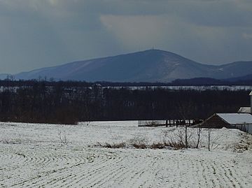
Clarks Knob is a special mountain peak located in Franklin County, Pennsylvania. It stands out as the highest point on Blue Mountain. This mountain range is part of the larger Ridge and Valley Appalachians region in Pennsylvania.
Where is Clarks Knob Located?
Clarks Knob is found in the beautiful state of Pennsylvania, in the United States. It's part of the long Blue Mountain range. This mountain is quite tall, reaching 2,316 feet (about 706 meters) high!
The Geography of Clarks Knob
The top ridge of Clarks Knob runs from northeast to southwest. This ridge acts like a natural divider for water. It separates the areas where water flows into the Susquehanna River from where it flows into the Potomac River.
From the top of Clarks Knob, you can look down over 1,600 feet (about 488 meters) to the town of Chambersburg. You can also see the wide Great Appalachian Valley. This mountain is a protected area within the Buchanan State Forest. This means the forest and its wildlife are kept safe and sound.
 | Percy Lavon Julian |
 | Katherine Johnson |
 | George Washington Carver |
 | Annie Easley |


