Cleveland, North Dakota facts for kids
Quick facts for kids
Cleveland, North Dakota
|
|
|---|---|

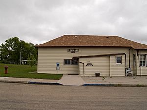
City Hall in Cleveland
|
|

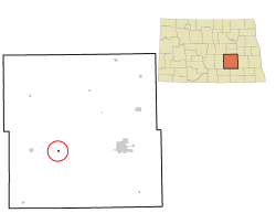
Location of Cleveland, North Dakota
|
|
| Country | United States |
| State | North Dakota |
| County | Stutsman |
| Founded | 1882 |
| Area | |
| • Total | 0.21 sq mi (0.55 km2) |
| • Land | 0.21 sq mi (0.55 km2) |
| • Water | 0.00 sq mi (0.00 km2) |
| Elevation | 1,873 ft (571 m) |
| Population
(2020)
|
|
| • Total | 57 |
| • Estimate
(2022)
|
60 |
| • Density | 268.87/sq mi (103.95/km2) |
| Time zone | UTC-6 (Central (CST)) |
| • Summer (DST) | UTC-5 (CDT) |
| ZIP code |
58424
|
| Area code(s) | 701 |
| FIPS code | 38-14660 |
| GNIS feature ID | 1035971 |
Cleveland is a small city located in Stutsman County, North Dakota, in the United States. In 2020, about 57 people lived there.
Contents
History of Cleveland
Cleveland was started in 1882. It got its name from the bigger city of Cleveland, Ohio. A post office has been open in Cleveland since it was founded.
Geography of Cleveland
The city of Cleveland is quite small. It covers about 0.21 square miles (0.55 square kilometers) of land. There is no water area within the city limits.
Population and People
| Historical population | |||
|---|---|---|---|
| Census | Pop. | %± | |
| 1920 | 341 | — | |
| 1930 | 273 | −19.9% | |
| 1940 | 246 | −9.9% | |
| 1950 | 181 | −26.4% | |
| 1960 | 169 | −6.6% | |
| 1970 | 128 | −24.3% | |
| 1980 | 130 | 1.6% | |
| 1990 | 121 | −6.9% | |
| 2000 | 112 | −7.4% | |
| 2010 | 83 | −25.9% | |
| 2020 | 57 | −31.3% | |
| 2022 (est.) | 60 | −27.7% | |
| U.S. Decennial Census 2020 Census |
|||
Cleveland's Population in 2010
In 2010, the census showed that 83 people lived in Cleveland. These people lived in 40 different homes. All of the residents were White.
See also
- In Spanish: Cleveland (Dakota del Norte) para niños
Black History Month on Kiddle
Famous African-American Scientists:
 | Charles R. Drew |
 | Benjamin Banneker |
 | Jane C. Wright |
 | Roger Arliner Young |

All content from Kiddle encyclopedia articles (including the article images and facts) can be freely used under Attribution-ShareAlike license, unless stated otherwise. Cite this article:
Cleveland, North Dakota Facts for Kids. Kiddle Encyclopedia.
