Clinton, Washington facts for kids
Quick facts for kids
Clinton, Washington
|
|
|---|---|

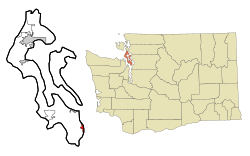
Location of Clinton, Washington
|
|
| Country | United States |
| State | Washington |
| County | Island |
| Area | |
| • Total | 3.7 sq mi (9.5 km2) |
| • Land | 1.0 sq mi (2.5 km2) |
| • Water | 2.7 sq mi (7.0 km2) |
| Elevation | 128 ft (39 m) |
| Population
(2020)
|
|
| • Total | 956 |
| • Density | 258/sq mi (100.6/km2) |
| Time zone | UTC-8 (Pacific (PST)) |
| • Summer (DST) | UTC-7 (PDT) |
| ZIP code |
98236
|
| Area code(s) | 360 |
| Telephone exchanges | 341, 579 |
| FIPS code | 53-13155 |
| GNIS feature ID | 1512098 |
Clinton is a small community in Washington, United States. It is located on the southern part of Whidbey Island in Island County. The town got its name from Clinton, Michigan.
Even though Clinton is a small village, many people who live up to 7 miles (11.5 km) away consider it their home. Much of the village sits on a high cliff. This cliff overlooks Saratoga Passage on Puget Sound. However, the nearby community of Columbia Beach is right at sea level. The original part of Clinton, where the community first began, is located north of the ferry dock.
Clinton is a very important place for travel. It is where the Washington State Ferries route from Whidbey Island (Clinton) to Mukilteo begins. This ferry route connects Whidbey Island to the mainland. State Route 525 and other main roads also serve the area.
As of the 2020 census, about 956 people lived in Clinton. However, the local post office serves a larger area, reaching at least 2,500 people.
The Sno-Isle Regional Library System has a library in Clinton. It is supported by a group called "Friends of the Clinton Library." There are also two grocery stores in Clinton. One is in the main downtown area, and the other is a few miles west.
Clinton is known for having a good per capita income. It ranks 79th out of 522 areas in Washington state. This is the highest rank in all of Island County.
Where is Clinton Located?
Clinton is found at 47°58′34″N 122°21′22″W / 47.976194°N 122.356245°W.
The United States Census Bureau says that Clinton covers a total area of about 3.7 square miles (9.5 square kilometers). Most of this area, about 2.7 square miles (7.0 square kilometers), is water. The land area is about 1.0 square mile (2.5 square kilometers). This means a large part of Clinton is made up of water, like bays and parts of the Puget Sound.
Who Lives in Clinton?
In 2000, there were 868 people living in Clinton. They lived in 388 households, and 254 of these were families. The population density was about 903 people per square mile.
Most people in Clinton were White (92.51%). There were also smaller numbers of African American, Native American, and Asian residents. About 2.88% of people were from two or more races. About 1.04% of the population was Hispanic or Latino.
The average household had 2.24 people, and the average family had 2.68 people.
The population was spread out by age:
- 20.2% were under 18 years old.
- 5.2% were from 18 to 24 years old.
- 23.4% were from 25 to 44 years old.
- 30.4% were from 45 to 64 years old.
- 20.9% were 65 years or older.
The average age in Clinton was 46 years.
Images for kids
See also
 In Spanish: Clinton (Washington) para niños


