
Mukilteo, Washington facts for kids
Quick facts for kids
Mukilteo
bək̓ʷəɬtiwʔ
|
||
|---|---|---|
.jpg)
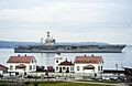
The USS Nimitz passing the Mukilteo Lighthouse
|
||
|
||

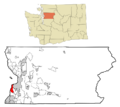
Location of Mukilteo, Washington
|
||
| Country | United States | |
| State | Washington | |
| County | Snohomish | |
| Established | c. 1857 | |
| Incorporated | May 8, 1947 | |
| Government | ||
| • Type | Mayor–council | |
| Area | ||
| • Total | 7.44 sq mi (19.26 km2) | |
| • Land | 6.26 sq mi (16.20 km2) | |
| • Water | 1.18 sq mi (3.06 km2) | |
| Elevation | 0−596 ft (0−182 m) | |
| Population
(2020)
|
||
| • Total | 21,538 | |
| • Estimate
(2022)
|
21,096 | |
| • Density | 2,894.89/sq mi (1,118.28/km2) | |
| Time zone | UTC−8 (PST) | |
| • Summer (DST) | UTC−7 (PDT) | |
| ZIP Code |
98275
|
|
| Area code | 425 | |
| FIPS code | 53-47735 | |
| GNIS feature ID | 1512491 | |
Mukilteo (pronounced MUK-əl-TEE-oh; in the Lushootseed language: bək̓ʷəɬtiwʔ) is a city in Snohomish County, Washington, United States. It is located on Puget Sound between the cities of Edmonds and Everett. Mukilteo is about 25 miles (40 km) north of Seattle. In 2020, the city had a population of 21,538 people.
The area where downtown Mukilteo is now, also called Old Town, has been home to the Snohomish people for at least 1,000 years. An important agreement, the Treaty of Point Elliott, was signed here in 1855. This treaty allowed American settlers to move into the region. A new town was started in Mukilteo and even served as the first temporary county seat for Snohomish County in 1861. The area continued as a trading post for loggers and other businesses, but it grew slowly compared to nearby Everett.
During World War II, Mukilteo was used as a place to refuel ships because it was close to the new Snohomish County Airport (now called Paine Field). Mukilteo officially became a city in 1947. New neighborhoods began to grow, especially after the Boeing Everett Factory opened nearby in the late 1960s. In the 1980s and 1990s, the city added large suburban areas like Harbour Pointe. At the same time, the Old Town area was improved in the 2000s.
Today, Mukilteo is mostly a bedroom community, meaning many people who live there travel to other cities for work. It also has some manufacturing jobs. Mukilteo is a key transportation spot. You can take Washington State Ferries to Whidbey Island, Sounder commuter trains to Seattle, and public transit buses to nearby cities. The city is known for its good quality of life and is one of the wealthiest in Washington state, with high average incomes.
Contents
- Understanding the Name Mukilteo
- Mukilteo's Past: A Look at History
- Mukilteo's Location and Features
- Mukilteo's Economy and Jobs
- People and Population in Mukilteo
- City Government and How It Works
- Mukilteo's Culture and Fun Activities
- Education in Mukilteo
- Mukilteo's Infrastructure and Services
- Images for kids
- See also
Understanding the Name Mukilteo
The name Mukilteo comes from Lushootseed, the language spoken by the Snohomish people and other Coast Salish tribes. The name for this area in Lushootseed is spelled in different ways, like bəqɬtiuʔ or bək̓ʷəɬtiwʔ. Over time, English speakers changed it to Mukilteo.
The exact meaning of the name is not fully clear. Some old records and sources from the Snohomish tribe say the meaning was unknown. However, other people believe the name means "good camping ground" or "narrow passage."
Mukilteo's Past: A Look at History
Early Days and Settlement

The Snohomish people had a village in the Mukilteo area for at least 600 years before European and American explorers arrived in the 1800s. Old items found during construction in the 2010s showed that people lived here as far back as 1,000 years ago.
British explorer George Vancouver visited the area on May 30, 1792. His team landed at what is now Mukilteo the next day. They named the spot "Rose Point" because of the wild Nootka roses growing there. Later, in 1841, an American group led by Charles Wilkes renamed it "Point Elliott."
After the Washington territorial government was set up in 1853, they wanted to make agreements with the local tribes. These agreements would allow settlers to use the land. On January 22, 1855, leaders from the government and 82 local tribes signed the Treaty of Point Elliott in Mukilteo. This treaty gave tribal lands to the government. In return, the tribes received payments, special Indian reservations, and the right to continue hunting and fishing in their traditional areas.
Two years later, in 1857, American merchants Morris H. Frost and J. D. Fowler started a settlement at Point Elliott. They opened a store and a saloon. In 1860, Fowler renamed the area Mukilteo, using an English version of the local tribal name.
Mukilteo became the first trading post in the area. It was also the temporary county seat for the new Snohomish County starting in January 1861. However, in July 1861, voters chose to move the county seat to Cadyville (now Snohomish).
Mukilteo remained an important port and trading center for the Possession Sound region. It soon got the county's first post office and telegraph station. The town moved to a more protected part of Point Elliott and supported the local lumber industry. By the 1880s, Mukilteo also had a brewery, a gunpowder factory, and the first cannery in the Puget Sound area. There were plans for Mukilteo to become a large port and a summer resort, but these plans stopped when the nearby city of Everett was developed by wealthy industrialists.
The Early 1900s

The Seattle and Montana Railroad (which later became part of the Great Northern Railway) was finished in 1891. This connected Mukilteo to Everett, Edmonds, and Seattle. Mukilteo was set up with streets and lots in hopes of becoming a major railroad stop. However, it lost out to Tacoma in 1873 as the end point for the Northern Pacific Railway.
After an economic downturn in the 1890s, Mukilteo saw a big increase in jobs and people. A larger lumber mill and gunpowder factory were built along the shore. The famous Mukilteo Lighthouse was built in 1906 by the federal Lighthouse Service. This helped guide the many ships coming and going.
Japanese immigrants came to work in Mukilteo's mills in the early 1900s. They created a Japanese community in what is now called Japanese Gulch. Passenger ferry service between Mukilteo and Whidbey Island started in 1911. Car ferry service began in 1919. The town also got a highway connection to Everett in 1914, which was later named Mukilteo Boulevard. Until the lumber mill closed in 1930, Mukilteo was a company town. This meant the Crown Lumber Company helped with many town services, like parks and the fire department. At its busiest, the mill employed 250 men.
During the Prohibition Era, when alcohol was illegal, Mukilteo became a key spot for smuggling alcohol from British Columbia to Seattle. On September 17, 1930, the town's gunpowder plant exploded after hours. No one was killed, but eight people were hurt, and dozens of homes were damaged. The explosion caused $500,000 in damage and was felt as far away as downtown Everett. In August 1938, the empty lumber mill was destroyed in a fire. This happened just weeks after a ferry crashed into and destroyed the town's wharf.
When the United States entered World War II, the government bought the old lumber mill site. They built a 1,500-foot (460 m) long dock to load ammunition onto warships. The nearby Snohomish County Airport (Paine Field) became a military base, though it still had some civilian flights. In the early 1950s, the loading dock was expanded with ten large storage tanks. These tanks stored jet fuel for military planes until 1989.
Becoming a City and Growth in the Late 1900s

On April 29, 1947, Mukilteo residents voted to officially become a city. They elected Alfred Tunem as their first mayor. The state government approved this on May 8. At that time, Mukilteo had about 775 people and covered 794 acres (321 ha). The new city government took over services that a local improvement club had been handling.
The area grew even more after Boeing opened its Paine Field factory in 1967. This factory built passenger jetliners. A short railroad connected the factory to Mukilteo. The Boeing Freeway opened in 1969. This road linked southern Mukilteo and the Boeing plant to Interstate 5.
Mukilteo added its first large area in November 1980. This added 2,500 people and 2 square miles (5.2 km2) to the south along State Route 525. This annexation almost tripled the city's population and doubled its land area. By the end of the 1980s, the city's population reached 6,000.
The large Harbour Pointe community was added in 1991. This doubled the city's size to 6.6 square miles (17 km2). Some people wanted Harbour Pointe to become its own city, but residents chose to join Mukilteo. This helped lower their taxes and get city services. The county government's plans to allow passenger flights from Paine Field also influenced this decision. Many residents in Mukilteo and Harbour Pointe were against these flights. The county eventually dropped its plan for passenger flights at that time.
The annexation of Harbour Pointe added 4,779 residents and 3.4 square miles (8.8 km2) to Mukilteo. This meant the city needed two new fire stations, three schools, and a new city hall. Kamiak High School was built in Harbour Pointe and opened in 1993. It served Mukilteo, which had outgrown Mariner High School. Kamiak High School focused on technology. By 2000, the full development of Harbour Pointe increased the city's population to over 18,000. This was a huge increase from 1980. The main center of Mukilteo shifted south towards Harbour Pointe.
Mukilteo in the 21st Century
.jpg)
In 1999, an agreement was made to transfer the Mukilteo Lighthouse from the U.S. Coast Guard to the city. The Coast Guard still uses the lights, but the city now manages the lighthouse as a tourist spot. This change happened on August 19, 2001.
The nearby Mukilteo State Park was given to the city in February 2003. The city then spent $6.6 million to improve the park, adding a playground and other features. These renovations were finished in 2008.
A 22-acre (8.9 ha) area on the waterfront, which used to be a fuel storage complex, was chosen for new development. This included a new ferry terminal. The Port of Everett cleaned up the site and built a new pier to transport large airplane parts for the Boeing 787 project. The cleanup was finished in late 2006. The old pier was taken down in 2015 to make way for the new ferry terminal, which opened on December 29, 2020. The new terminal connects to a nearby commuter rail station, which opened in 2008 and was expanded in 2016.
A research station for the Northwest Fisheries Science Center on the old fuel tank site closed in 2020. Plans to build a new facility were canceled in March 2021 because the bids were too expensive. The city and the Port of Everett have long-term plans to develop 26 acres (11 ha) around the old ferry terminal and the research station. They want to create a walkable neighborhood with a waterfront path and trails.
In July 2016, a tragic event happened at a house party in Mukilteo. Three people were killed and one was seriously hurt. The person responsible was a graduate of Kamiak High School and was sentenced to life in prison. This event, along with others, helped inspire a new law about certain types of weapons, which voters approved in 2018. In February 2018, a person was arrested before a planned school shooting that would have targeted local high schools.
Mukilteo's Location and Features

Mukilteo is in the southwestern part of Snohomish County, about 25 miles (40 km) north of Seattle. The city stretches mostly north to south, being about 5.4 miles (8.7 km) long and 0.8 to 2.1 miles (1.3 to 3.4 km) wide. To the west, it borders Possession Sound, which is part of Puget Sound. To the north, it borders Port Gardner Bay.
Mukilteo's eastern border with Everett follows 44th Avenue and Japanese Gulch until it reaches State Route 526. From there, the city's eastern edge continues along State Route 525, next to the west side of Paine Field. Mukilteo's southern border is defined by Beverly Park Road, the Picnic Point Ravine, and Hulk Creek.
The United States Census Bureau says the city covers a total area of 9.50 square miles (24.60 km2). Of this, 6.40 square miles (16.58 km2) is land and 3.10 square miles (8.03 km2) is water. Mukilteo also has a special urban growth area that extends south to 148th Street Southwest, bordering Lynnwood, and east to State Route 99. In 2010, city voters rejected a plan to add this entire urban growth area, which had about 11,000 people.
Most of Mukilteo is on a high plateau that looks out over Possession Sound and the Olympic Mountains to the west. A main railroad line runs along the shore, below tall cliffs. These cliffs are broken up by ravines and gulches where several creeks flow. The cliffs formed about 5,000 years ago and have slowly worn away to create beaches and Point Elliott. The city has several important drainage areas, including Japanese Gulch, Big Gulch, the Chennault Ravines, and Picnic Point Gulch. Mukilteo is also crossed by the Southern Whidbey Island Fault, a shallow earthquake fault line found in 1996.
Mukilteo's Neighborhoods

Except for Old Town Mukilteo, the city is divided into several large neighborhoods. These are named after the different developed areas that were added to the city in the late 1900s. Some of these neighborhoods include Chennault Beach, Harbour Pointe, Olympus Terrace, and Picnic Point. The city's urban growth area also includes the neighborhoods of Lake Serene, Meadowdale, and Lake Stickney.
Old Town Mukilteo is at the north end of the city, between Port Gardner Bay and 5th Street (Mukilteo Boulevard). The city's famous lighthouse is on Point Elliott, at the northwest corner of Old Town. It is next to the Washington State Ferries terminal and the commuter train station. The only way to get from the waterfront to the rest of Mukilteo is by the Mukilteo Speedway (State Route 525), which also handles ferry traffic. Another street, Mukilteo Lane, was closed in 2008 due to severe erosion.
Mukilteo's largest neighborhood is Harbour Pointe. It covers 2,341 acres (947 ha) in the south-central part of the city, between Possession Sound and State Route 525. It borders South Gulch and Picnic Point to the south, and Big Gulch and Olympus Terrace to the north. This area was once owned by a lumber company and later sold to Standard Oil in 1952. Standard Oil planned to build an oil refinery at Picnic Point. However, after protests against a similar plan in the 1960s, Standard Oil gave up on building refineries in Snohomish County. They then turned over the Picnic Point site to the county government and private developers.
Development of Harbour Pointe began in 1978. Its first part was finished in 1989 with the opening of the neighborhood's golf course. A public marina was suggested for the Chenault Beach part of the development in 1983, but it was rejected. This was due to concerns from fisheries officials about how it might affect local fishing. Mukilteo added Harbour Pointe to the city in 1991. Today, it is home to Kamiak High School, the city library, and a large industrial area.
Mukilteo's Weather
Mukilteo has weather similar to most of the Puget Sound area. It has dry summers and mild, rainy winters. The weather is made milder by the influence of the Pacific Ocean. On average, the area gets about 38.55 inches (979 mm) of rain each year, mostly spread over about seven months. Mukilteo is also in the Puget Sound Convergence Zone. This is a local weather pattern that affects parts of Snohomish County.
| Climate data for Mukilteo, Washington | |||||||||||||
|---|---|---|---|---|---|---|---|---|---|---|---|---|---|
| Month | Jan | Feb | Mar | Apr | May | Jun | Jul | Aug | Sep | Oct | Nov | Dec | Year |
| Record high °F (°C) | 67 (19) |
74 (23) |
82 (28) |
85 (29) |
93 (34) |
103 (39) |
93 (34) |
94 (34) |
89 (32) |
80 (27) |
— | 66 (19) |
103 (39) |
| Mean daily maximum °F (°C) | 48 (9) |
51 (11) |
55 (13) |
60 (16) |
65 (18) |
70 (21) |
75 (24) |
75 (24) |
70 (21) |
61 (16) |
52 (11) |
46 (8) |
61 (16) |
| Mean daily minimum °F (°C) | 35 (2) |
34 (1) |
37 (3) |
41 (5) |
46 (8) |
51 (11) |
54 (12) |
54 (12) |
49 (9) |
42 (6) |
38 (3) |
33 (1) |
43 (6) |
| Record low °F (°C) | 1 (−17) |
2 (−17) |
10 (−12) |
27 (−3) |
29 (−2) |
37 (3) |
39 (4) |
40 (4) |
31 (−1) |
22 (−6) |
0 (−18) |
5 (−15) |
0 (−18) |
| Average precipitation inches (mm) | 5.11 (130) |
3.19 (81) |
3.69 (94) |
3.00 (76) |
2.67 (68) |
2.30 (58) |
1.17 (30) |
1.15 (29) |
1.95 (50) |
3.58 (91) |
5.57 (141) |
5.17 (131) |
38.55 (979) |
| Source: The Weather Channel | |||||||||||||
Mukilteo's Economy and Jobs
Mukilteo is mainly a bedroom community. This means many people live there but work in other cities. Most jobs in Mukilteo are in an industrial park near Harbour Pointe and in smaller office parks. In 2017, the city had about 10,557 jobs. The largest number of these jobs were in manufacturing and services.
The biggest employer in Mukilteo is the Mukilteo School District. After that, the Boeing Technical Center in Harbour Pointe employs over 1,200 people. Several companies have their main offices or operations in Mukilteo. These include Electroimpact (aerospace equipment), Rane (audio equipment), Kaas Tailored (furniture), Synrad (lasers), and Travis Industries (stoves).
As of 2015, Mukilteo had about 16,935 people in its workforce. The unemployment rate was 6.7 percent. Less than 7 percent of the city's workers have jobs within Mukilteo itself. Most people travel to jobs in other cities. Over 26 percent of workers commute to Everett, where the Boeing Assembly Plant and the county government are located. About 19 percent travel to Seattle, 6 percent to Bellevue, and 5 percent to Lynnwood.
People and Population in Mukilteo
| Historical population | |||
|---|---|---|---|
| Census | Pop. | %± | |
| 1950 | 826 | — | |
| 1960 | 1,128 | 36.6% | |
| 1970 | 1,369 | 21.4% | |
| 1980 | 1,426 | 4.2% | |
| 1990 | 7,007 | 391.4% | |
| 2000 | 18,019 | 157.2% | |
| 2010 | 20,254 | 12.4% | |
| 2020 | 21,538 | 6.3% | |
| 2022 (est.) | 21,096 | 4.2% | |
| U.S. Decennial Census | |||
Mukilteo is the ninth largest city in Snohomish County. In the 2020 census, it had a population of 21,538. The city has a notable number of Asian American residents, a group that started growing in the late 1980s. Mukilteo is one of the wealthier suburbs of Seattle. The average household income is $94,863, and the average income per person is $44,690.
In 2009, Money magazine ranked Mukilteo 10th on a list of the top 100 small U.S. towns to live in. This ranking was based on things like quality of life. In 2011, Mukilteo moved up to ninth place, becoming the only city on the West Coast in the top 10. In 2006, BusinessWeek magazine also recognized Mukilteo as one of the best affordable suburbs. This was because housing prices were lower than in King County cities, and it had a low crime rate.
Population in 2010
According to the 2010 census, Mukilteo had 20,254 people living in 8,057 households. There were 5,660 families. The city had about 3,165 people per square mile (1,222/km2). There were 8,547 housing units.
The racial makeup of the city was mostly White (74.9%). There were also significant numbers of Asian residents (17.1%), African American (1.7%), Native American (0.6%), and Pacific Islander (0.2%). About 4.5% of people were from two or more races. People of Hispanic or Latino background made up 4.4% of the population.
Of the 8,057 households, 34.1% had children under 18. About 57.9% were married couples living together. The average household had 2.51 people, and the average family had 3.00 people.
The average age in the city was 41.8 years. About 23.2% of residents were under 18, and 10.6% were 65 or older. The population was almost evenly split between males (50.2%) and females (49.8%).
City Government and How It Works

The City of Mukilteo uses a mayor–council government. This means it has a mayor and a seven-member city council. Both the mayor and council members are elected for four-year terms. Elections are held every two years for some of the council seats. These elections are nonpartisan, meaning candidates do not run as members of political parties. Joe Marine was re-elected as mayor in 2021 for his third term.
The city government has 113 full-time employees. In 2016, its budget was $32 million, mostly paid for by sales taxes. As of 2024, the total sales tax rate in Mukilteo is 10.6 percent, which is one of the highest in Washington.
Mukilteo has its own police and fire services. It also has departments for recreation, planning, and public works. Other services, like utilities, garbage collection, public transportation, and the library, are handled by regional agencies and organizations.
Mukilteo's city hall is in Harbour Pointe. It was built in 2008 and cost $8.5 million. The building was designed to be environmentally friendly, using recycled materials. Before this, the city hall was in the Rosehill Community Center in Old Town. It then moved temporarily to a rented warehouse in Harbour Pointe in 1992 to make space for more employees.
At the national level, Mukilteo has been part of the 2nd congressional district since 2012. This district is represented by Democrat Rick Larsen. At the state level, Mukilteo and Edmonds make up the 21st legislative district. Mukilteo is also part of the Snohomish County Council's 2nd district.
Mukilteo's Culture and Fun Activities
City Events
The city's main yearly event is the Mukilteo Lighthouse Festival. It lasts for three days and is held at Mukilteo Lighthouse Park in late August or early September. This festival started in 1965. It includes a parade, fireworks, a fishing derby, and fun runs.
The city also organizes a farmers' market at Mukilteo Lighthouse Park. It runs on weekends during the summer months. The farmers' market season in 2019 was canceled because there weren't enough volunteers.
Parks and Outdoor Fun

Mukilteo has a total of 1,154 acres (467 ha) of open space. This includes 611 acres (247 ha) of public parks and 342 acres (138 ha) of privately owned open spaces. These areas make up 13 percent of the city's total land. The largest open spaces are conservation areas in the Big Gulch and Japanese Gulch areas.
Mukilteo's parks are managed by a city department that also plans fun activities for residents. This department is funded by a measure that voters approved in 1996. Besides city parks, Mukilteo is also near Picnic Point Park. This is a 54-acre (22 ha) county park along Puget Sound.
The Old Town neighborhood has several of the city's main parks. One is Mukilteo Lighthouse Park, which used to be a state park. Mukilteo took it over in 2003, and it is now the city's most-used park. This 12-acre (4.9 ha) park has a beach, a boat launch, a playground, and picnic areas. Southeast of the waterfront park is the Rosehill Community Center, which is the city's main multi-purpose recreation center. It was built in 2011 to replace an older community center.
The Japanese Gulch conservation area is between Old Town and Paine Field. It is the most used natural area in Mukilteo. This 144-acre (58 ha) area is mostly forests and wetlands. It is home to many birds, as well as salmon, deer, and mountain beavers. It has several hiking trails that were created by Japanese immigrants who lived in the gulch in the early 1900s. The city government bought land in the gulch in different stages between 1996 and 2014. A park with dirt tracks for BMX bikes opened at the southwest end of Japanese Gulch in 2024.
The city's largest conservation area is Big Gulch. It is near Harbour Pointe and has 180 acres (73 ha) of protected land and 2.5 miles (4.0 km) of trails. At the northeast corner of Big Gulch is Mukilteo's largest neighborhood park, 92nd Street Park. It covers 13 acres (5.3 ha) along the Mukilteo Speedway. It has a playground, hiking trails, picnic tables, and a dog park.
Media and Information
Mukilteo's public library is run by the Sno-Isle Libraries system and is located in Harbour Pointe. It opened on July 27, 1998. The city's voters approved joining the library system in 1996. Mukilteo's first library opened in 1963. It closed on December 31, 1994, due to budget cuts.
The city's main newspaper is the Mukilteo Beacon. It is published weekly and started on July 22, 1992. It has sister papers in Edmonds and Mill Creek. Mukilteo news is also covered by The Everett Herald and The Seattle Times, which are daily newspapers for the region.
Well-Known People
- Anita Borg, computer scientist
- Heather Boushey, economist
- Tim Eyman, political activist
- Marko Liias, state senator
- James Mongrain, glass sculptor
- Lillian Ortiz-Self, state legislator
- Gina Segadelli, former soccer player
- Brian Sullivan, former mayor
- Andy Walken, actor
- Jim Watkins, businessman
- Ron Watkins, conspiracy theorist
- The Fall of Troy, a band with members Thomas Erak, Andrew Forsman, and Tim Ward
Education in Mukilteo

The Mukilteo School District was started in 1878. It manages the public schools in Mukilteo and nearby areas of south Everett. The district serves about 93,222 people across 26 square miles (67 km2) and has about 15,000 students.
Seven of the district's 24 schools are located within Mukilteo city limits. These include Kamiak High School, two middle schools, and four elementary schools. Kamiak High School opened in 1993 to help with overcrowding at Mariner High School. Kamiak High School has a high student graduation rate of 94 percent.
Mukilteo is also near two community colleges: Edmonds College and Everett Community College. These colleges offer two-year degree programs. The city also has three private schools for preschool and kindergarten education.
Mukilteo's Infrastructure and Services
Getting Around: Transportation

.jpg)
Downtown Mukilteo is a major transportation hub. It has state highways, ferries, commuter trains, and buses. The city is divided north to south by State Route 525, also known as the Mukilteo Speedway. This road connects the downtown ferry terminal to Harbour Pointe, State Route 99, and Interstate 5. State Route 526 (the Boeing Freeway) runs west to east. It provides direct connections to the Boeing Everett Factory and Interstate 5. Other important roads include Mukilteo Boulevard, which connects the city to Everett, and Harbour Pointe Boulevard, which goes around the Harbour Pointe neighborhood and golf course.
State Route 525 continues north from Mukilteo to Whidbey Island on the Clinton ferry. This ferry is run by Washington State Ferries. The Clinton–Mukilteo ferry route is the busiest in the state for cars and the second busiest overall. It carries 4 million passengers and 2.2 million vehicles each year. The old Mukilteo ferry terminal was built in 1952. A new terminal began construction in 2018 and opened on December 29, 2020.
The city also has three public transportation agencies. Sound Transit runs Sounder commuter trains from Mukilteo station to Seattle during busy weekday hours. Local buses are operated by Community Transit and Everett Transit. Community Transit buses have routes connecting Mukilteo and Harbour Pointe to Lynnwood and the Boeing Everett Factory. Everett Transit runs one route in Mukilteo, connecting downtown and the ferry terminal to Everett. Mukilteo is the largest city in Snohomish County without a dedicated park and ride facility for Community Transit.
Paine Field is southeast of Mukilteo. It serves the Boeing Everett Factory, as well as smaller planes and passenger flights, which started again in 2019. The passenger terminal is on the east side of the airport, facing Everett. The west side in Mukilteo has two museums: the Future of Flight Aviation Center (which includes a tour of the Boeing factory) and the Historic Flight Foundation. The Mukilteo city government has been against the airport being used for passenger flights since the 1990s. They are concerned about noise and traffic.
Utilities and Services
Electric power in Mukilteo is provided by the Snohomish County Public Utility District (PUD). This is a public utility that serves all of Snohomish County. Puget Sound Energy provides natural gas service to the city's homes and businesses. The city government also works with Waste Management and Rubatino Refuse Removal for curbside garbage, recycling, and yard waste collection.
Mukilteo's tap water and sewage systems are managed by the Mukilteo Water and Wastewater District and the Alderwood Water District. The Mukilteo district, founded in 1920, serves most of the city and part of south Everett. The Alderwood district extends into Edmonds and Lynnwood. The city government used to run its own sewage treatment plant until the 1990s. The Big Gulch Wastewater Plant near Harbour Pointe opened in 1970 and is now the main outflow for Mukilteo and the rest of the water district.
A major submarine communications cable system called Pacific Crossing uses fiber-optic cables that go from Mukilteo and Grover Beach, California, to Japan. The cable's switching center is in Harbour Pointe.
Health Care
Mukilteo is located near two general hospitals. These are the Providence Regional Medical Center in Everett and Swedish Edmonds Hospital in Edmonds.
Images for kids
-
The USS Nimitz passing the Mukilteo Lighthouse
-
Location of Mukilteo, Washington
-

City of Mukilteo logo
See also
 In Spanish: Mukilteo (Washington) para niños
