Coast to Vines Rail Trail facts for kids
Quick facts for kids Coast to Vines Rail Trail |
|
|---|---|

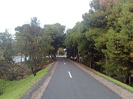
Section of the Coast to Vines rail trail in Old Reynella, facing South
|
|
| Length | 34 km (21 mi) |
| Location | southern suburbs of Adelaide, South Australia |
| Trailheads | Marino Rocks railway station, Willunga railway station |
| Use | Hiking, cycling |
| Season | all |
| Sights | Gulf St Vincent, McLaren Vale wine region, Onkaparinga River |
| Hazards | some at-level road crossings |
| Surface | sealed |
| Right of way | Willunga railway line |
| Website | http://www.railtrails.org.au/trail-descriptions/south-australia?view=trail&id=199 |
The Coast to Vines rail trail is a special path in South Australia. It's perfect for walking and cycling! This trail follows an old railway line that isn't used anymore. It stretches for 34 kilometers (about 21 miles) from Marino to Willunga, in the southern suburbs of Adelaide.
Contents
Exploring the Coast to Vines Trail
This trail is a great way to explore the beautiful scenery of South Australia. It's open all year round, so you can enjoy it whenever you like!
What is a Rail Trail?
A rail trail is a path made from an old railway line. When trains stop using a track, the land can be turned into a safe path. These paths are great for people who want to walk, run, or cycle. They often go through interesting places and are usually quite flat.
Where Does the Trail Start?
The Coast to Vines trail begins near the Marino Rocks railway station. This is in the northern part of the trail. You can find the start on The Cove Road.
Journey Along the Trail
From Marino Rocks, the trail follows the Seaford railway line for a bit. Near the Hallett Cove railway station, you'll use a footbridge to cross over the train line.
After that, you'll pass by the Hallett Cove shops. The trail then crosses Lonsdale Highway. It goes through a very pretty area called Trott Park.
When you turn right onto Old South Road, you'll be on the part of the trail that was once the actual railway line. This section has lots of trees along both sides. It goes all the way to Hackham.
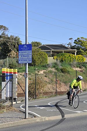
The path is mostly off-road, which means it's separate from busy roads. However, you will cross some roads along the way. Don't worry, the path and road crossings are clearly marked with signs. You'll also cross over small creeks like Christies Creek.
As you continue, the trail will lead you to the Onkaparinga River. From there, you can keep going to McLaren Vale and then to Willunga. Along the way, you might see sights like Gulf St Vincent and the famous McLaren Vale wine region.
Old Railway Stations
The railway line that this trail follows used to have many stations. Some of the old station names were Patpa, Happy Valley, Reynella, Morphett Vale, Hackham, Noarlunga, McLaren Vale, and Willunga.
Connecting Trails
The Coast to Vines trail was finished in 2007. A small part of it even runs along the main street of McLaren Vale. This trail also connects with another important path called the Patrick Jonker Veloway. It meets this veloway in two places: near the Panalatinga Road turnoff and at the southern end of the Southern Expressway.
 | Sharif Bey |
 | Hale Woodruff |
 | Richmond Barthé |
 | Purvis Young |


