Coatesville, Indiana facts for kids
Quick facts for kids
Town of Coatesville, Indiana
|
|
|---|---|
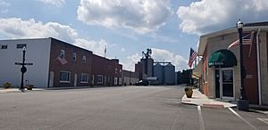
View down Main Street
|
|
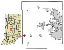
Location of Coatesville in Hendricks County, Indiana.
|
|
| Country | United States |
| State | Indiana |
| County | Hendricks |
| Township | Clay |
| Area | |
| • Total | 0.67 sq mi (1.72 km2) |
| • Land | 0.65 sq mi (1.69 km2) |
| • Water | 0.01 sq mi (0.03 km2) |
| Elevation | 876 ft (267 m) |
| Population
(2020)
|
|
| • Total | 555 |
| • Density | 849.92/sq mi (327.96/km2) |
| Time zone | UTC-5 (EST) |
| • Summer (DST) | UTC-4 (EDT) |
| ZIP code |
46121
|
| Area code(s) | 765 |
| FIPS code | 18-14050 |
| GNIS feature ID | 2396657 |
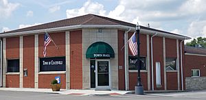
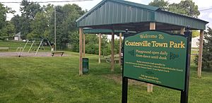
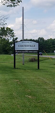
Coatesville is a small town located in Hendricks County, Indiana, United States. It is part of Clay Township. In 2020, about 555 people lived there.
Contents
Discovering Coatesville's Past
Coatesville started as a community in the late 1860s. It officially became a town in 1909.
A Look at Old Gas Stations
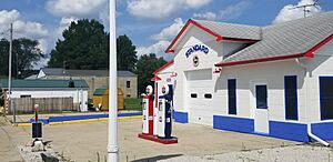
In the early 1900s, a place to get gas for cars, called a filling station, opened in downtown Coatesville. By 1958, the Standard Oil company ran it. At one time, Coatesville had three gas stations. Today, there are none. The spot where the first gas station stood has been rebuilt. It now looks like the Standard Oil station from the late 1950s.
The 1948 Tornado Event
On March 26, 1948, a powerful tornado hit Coatesville. It destroyed most of the town. Sadly, many people in Coatesville lost their lives. The tornado also caused damage and fatalities across other parts of west-central Indiana.
Coatesville's Location and Size
Coatesville covers a total area of about 0.67 square miles (1.72 square kilometers). Most of this area is land, about 0.65 square miles (1.69 square kilometers). A very small part, about 0.01 square miles (0.03 square kilometers), is water.
Who Lives in Coatesville?
| Historical population | |||
|---|---|---|---|
| Census | Pop. | %± | |
| 1880 | 499 | — | |
| 1910 | 472 | — | |
| 1920 | 522 | 10.6% | |
| 1930 | 434 | −16.9% | |
| 1940 | 377 | −13.1% | |
| 1950 | 444 | 17.8% | |
| 1960 | 497 | 11.9% | |
| 1970 | 453 | −8.9% | |
| 1980 | 474 | 4.6% | |
| 1990 | 469 | −1.1% | |
| 2000 | 516 | 10.0% | |
| 2010 | 523 | 1.4% | |
| 2020 | 555 | 6.1% | |
| U.S. Decennial Census | |||
Population Facts from 2010
According to the census from 2010, 523 people lived in Coatesville. There were 199 households, which are groups of people living together. About 147 of these were families.
Most people in the town were White (96.7%). A small number were from other backgrounds. About 1.3% of the population identified as Hispanic or Latino.
About one-third of the households (33.7%) had children under 18 living with them. Most households (58.3%) were married couples. The average household had about 2.63 people. The average family had about 3.05 people.
The average age of people in Coatesville was 41.4 years. About 25.4% of residents were under 18 years old. About 14.1% were 65 years or older. The town had a nearly equal number of males (49.3%) and females (50.7%).
Learning and Education
Coatesville has a public library called the Coatesville-Clay Township Public Library. It lends books and other materials to people in the community.
See also
 In Spanish: Coatesville (Indiana) para niños
 | Chris Smalls |
 | Fred Hampton |
 | Ralph Abernathy |


