Colburn, Chippewa County, Wisconsin facts for kids
Quick facts for kids
Town of Colburn, Wisconsin
|
|
|---|---|

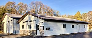
Town hall
|
|

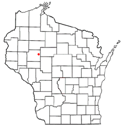
Location of Colburn
|
|
| Country | |
| State | |
| County | Chippewa |
| Area | |
| • Total | 66.4 sq mi (172.0 km2) |
| • Land | 64.8 sq mi (167.8 km2) |
| • Water | 1.7 sq mi (4.3 km2) |
| Elevation | 1,083 ft (330 m) |
| Population
(2010)
|
|
| • Total | 856 |
| • Density | 13/sq mi (5.1/km2) |
| Time zone | UTC-6 (Central (CST)) |
| • Summer (DST) | UTC-5 (CDT) |
| Area code(s) | 715 & 534 |
| FIPS code | 55-16125 |
| GNIS feature ID | 1582996 |
| PLSS township | T30N R5W and parts of T30N R6W and T31N R5W |
Colburn is a small town located in Chippewa County, which is in the state of Wisconsin in the United States. In 2010, about 856 people lived here. This was more than the 727 people who lived there in 2000.
Some smaller communities are also part of the town of Colburn. These include the areas simply called Colburn and Huron. Part of the community of Brownville is also found within the town's borders.
Learning in Colburn
Students in Colburn attend schools from several different districts. These include the School District of Cadott Community, Stanley-Boyd School District, Gilman School District, and Cornell School District. This means kids in Colburn have a few choices for where they go to school!
Colburn's Geography
Colburn is located in the eastern part of Chippewa County. It shares its eastern border with Taylor County. The town is shaped like a rectangle, measuring about 8 miles by 9 miles. However, a small piece of the northwest corner is taken up by the town of Estella.
The total area of Colburn is about 172 square kilometers (or 66.4 square miles). Most of this area, about 167.8 square kilometers (64.8 square miles), is land. The rest, about 4.3 square kilometers (1.7 square miles), is water.
The Yellow River flows through Colburn from the northeast to the south. This river is a branch of the larger Chippewa River. You can also find Otter Lake in the eastern part of the town.
Colburn's Past
The land that became Colburn was carefully measured and mapped in the mid-1800s. This work was done by teams working for the U.S. government. They surveyed the area between 1847 and the early 1850s.
In November 1849, one team marked all the corners of the land sections. They walked through the woods and swamps, using special tools like a chain and a compass. After they finished, the surveyor wrote down what they found.
He noted that there wasn't much land good for farming. He described the area as mostly flat and swampy. However, he did mention some good trees like pine, hemlock, fir, birch, sugar maple, and ash.
The surveyor also wrote about the Yellow River. He said it was important because it had many places suitable for mills. He described the river as having a fast current, a hard bottom, and banks that were often high and rocky.
People of Colburn
| Historical population | |||
|---|---|---|---|
| Census | Pop. | %± | |
| 1990 | 731 | — | |
| 2000 | 727 | −0.5% | |
| 2010 | 856 | 17.7% | |
| 2020 (est.) | 891 | 4.1% | |
Let's look at the people who live in Colburn, based on the census from the year 2000.
- Population: There were 727 people living in the town.
- Homes: There were 262 households, which means 262 homes where people lived. Out of these, 193 were families.
- Population Density: The town had about 11.2 people per square mile (or 4.3 people per square kilometer). This tells us how crowded an area is.
- Housing: There were 289 housing units in total.
- Racial Background: Most people (about 97.80%) were White. A smaller number were Native American, Asian, or from other races.
When looking at the households:
- About 35.5% of homes had children under 18 living there.
- Most homes (65.6%) were married couples living together.
- About 20.2% of all homes had people living alone.
- Nearly 10% of homes had someone 65 years or older living by themselves.
- On average, about 2.77 people lived in each household. For families, the average was 3.23 people.
The age breakdown of the population in 2000 was:
- 29.3% were under 18 years old.
- 6.5% were between 18 and 24 years old.
- 24.3% were between 25 and 44 years old.
- 25.0% were between 45 and 64 years old.
- 14.9% were 65 years or older.
The average age in Colburn was 39 years.
For every 100 females, there were about 109.5 males. If we only look at adults 18 and over, there were about 109.8 males for every 100 females.
In terms of money, the average income for a household in Colburn was $35,625. For families, the average income was $41,136. The average income per person in the town was $17,068. About 8.2% of families and 10.2% of all people in Colburn lived below the poverty line. This included 8.5% of those under 18 and 14.7% of those 65 or older.
See also
 In Spanish: Colburn (condado de Chippewa, Wisconsin) para niños

