Compton Glacier facts for kids
Quick facts for kids Compton Glacier |
|
|---|---|

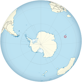
Location of Heard Island and McDonald Islands on the globe
|
|
| Type | cirque / tidewater |
| Location | Heard Island Territory of Heard Island and McDonald Islands Australia |
| Coordinates | 53°3′S 73°37′E / 53.050°S 73.617°E |
| Length | 3 nautical miles (6 km) |
| Thickness | 55 meters |
| Terminus | Compton Lagoon, between Gilchrist Beach and Fairchild Beach |
| Status | Retreating |
Compton Glacier is a large river of ice, about 3 nautical miles (6 km) long. It flows towards the northeast from the lower parts of the Big Ben mountain area. You can find it on the northeast side of Heard Island. This island is located far south in the Indian Ocean.
The end of the glacier, called its terminus, reaches Compton Lagoon. This lagoon is found between Gilchrist Beach and Fairchild Beach.
Contents
Compton Glacier: A Frozen River
Compton Glacier is a type of glacier that flows from a bowl-shaped hollow (a cirque) and also reaches the sea (a tidewater glacier). It's a significant feature on Heard Island, which is a remote and icy place.
Where is Compton Glacier?
Compton Glacier is on Heard Island, which is part of the Territory of Heard Island and McDonald Islands. This territory belongs to Australia. The island is known for its active volcano, Big Ben, and its many glaciers.
Compton Glacier has neighbors! To its northwest, you'll find Ealey Glacier. The end of Ealey Glacier is near Cape Bidlingmaier. To the southeast of Compton Glacier is Brown Glacier, which ends at Brown Lagoon. A place called Round Hill sits between Compton Glacier and Brown Glacier, keeping them separate.
How Was It Discovered and Named?
The story of Compton Glacier's discovery and naming involves early explorers and later scientific expeditions.
Early Explorers and Maps
The lower parts of this glacier were first mapped in 1860. An American sealer named Captain H.C. Chester created a sketch map and called this icy area "Morgan's Iceberg." Sealers were people who hunted seals for their fur and oil.
Modern Surveys and Naming
Much later, in 1948, the Australian National Antarctic Research Expeditions (ANARE) surveyed the area. They are a group that explores and studies the Antarctic region. This expedition officially named the feature Compton Glacier. It was named after G.S. Compton, who was an assistant surveyor on their team.
- To see a map of Heard Island and McDonald Islands, including all its main features, click here.
![]() This article incorporates public domain material from the United States Geological Survey document "Compton Glacier" (content from the Geographic Names Information System).
This article incorporates public domain material from the United States Geological Survey document "Compton Glacier" (content from the Geographic Names Information System).
See also
 In Spanish: Glaciar Compton para niños
 | Delilah Pierce |
 | Gordon Parks |
 | Augusta Savage |
 | Charles Ethan Porter |

