Conesville, Ohio facts for kids
Quick facts for kids
Conesville, Ohio
|
|
|---|---|
|
Village
|
|

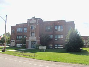
Conesville Elementary School
|
|

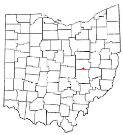
Location of Conesville, Ohio
|
|

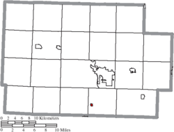
Location of Conesville in Coshocton County
|
|
| Country | United States |
| State | Ohio |
| County | Coshocton |
| Township | Franklin |
| Area | |
| • Total | 0.14 sq mi (0.36 km2) |
| • Land | 0.14 sq mi (0.36 km2) |
| • Water | 0.00 sq mi (0.00 km2) |
| Elevation | 742 ft (226 m) |
| Population
(2020)
|
|
| • Total | 328 |
| • Estimate
(2023)
|
326 |
| • Density | 2,359.71/sq mi (910.21/km2) |
| Time zone | UTC-5 (Eastern (EST)) |
| • Summer (DST) | UTC-4 (EDT) |
| ZIP code |
43811
|
| Area code(s) | 740 |
| FIPS code | 39-18266 |
| GNIS feature ID | 2398614 |
Conesville is a small village in Coshocton County, Ohio, United States. It is located right next to the Muskingum River. In 2020, about 328 people lived there.
Contents
Conesville History
Conesville was likely named after Beebe Stewart Cone. In 1847, he and three other men built a large distillery. This distillery was on the west side of the Muskingum River. Houses for workers and small shops were built nearby.
The first distillery burned down in 1857. Beebe Cone then left the business. Another man, James Beebe, rebuilt the distillery. However, it also burned down a few years later. Before 1840, a man named Delaney bought land in the same area. He wanted to name it Delaneysville, but his plans did not work out.
A big power plant, called the Conesville Power Plant, is located just east of the village. It began operating in 1957.
Conesville Geography
Conesville is a very small village. According to the United States Census Bureau, its total area is about 0.16 square miles (0.36 square kilometers). All of this area is land.
Conesville Population and People
| Historical population | |||
|---|---|---|---|
| Census | Pop. | %± | |
| 1950 | 466 | — | |
| 1960 | 451 | −3.2% | |
| 1970 | 448 | −0.7% | |
| 1980 | 451 | 0.7% | |
| 1990 | 420 | −6.9% | |
| 2000 | 364 | −13.3% | |
| 2010 | 347 | −4.7% | |
| 2020 | 328 | −5.5% | |
| 2023 (est.) | 326 | −6.1% | |
| U.S. Decennial Census | |||
The population of Conesville has changed over the years. In 1950, there were 466 people. By 2020, the population was 328.
Conesville in 2010
A census is a count of all the people in a place. The 2010 census showed that 347 people lived in Conesville. There were 134 households, which are groups of people living together. Of these, 98 were families.
The village had 146 housing units. Most residents were White, making up 100% of the population.
Households and Families
About 32.8% of households had children under 18 living with them. Most households (57.5%) were married couples living together. Some households had a female head (12.7%) or a male head (3.0%) without a spouse. About 26.9% were not families.
Also, 21.6% of all households were single individuals. About 13.4% of households had someone aged 65 or older living alone. The average household had 2.59 people. The average family had 2.98 people.
Age and Gender
The average age in Conesville was 37.5 years old. About 25.6% of residents were under 18. About 6% were between 18 and 24 years old. People aged 25 to 44 made up 28.2% of the population. Those aged 45 to 64 were 22.2%. Finally, 17.9% of residents were 65 years or older.
The village had slightly more females than males. About 46.7% of the population was male, and 53.3% was female.
See also
 In Spanish: Conesville (Ohio) para niños
 | Janet Taylor Pickett |
 | Synthia Saint James |
 | Howardena Pindell |
 | Faith Ringgold |

