Coniston Water facts for kids
Quick facts for kids Coniston Water |
|
|---|---|

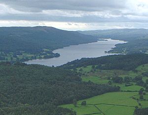
View from Holme Fell, 1.5 miles (2.4 km) north
|
|
| Location | Lake District, Cumbria |
| Coordinates | 54°21′N 3°04′W / 54.350°N 3.067°W |
| Primary outflows | River Crake |
| Max. length | 8.8 km (5.5 mi) |
| Max. width | 793 m (0.49 mi) |
| Surface area | 4.7 km2 |
| Average depth | 24.1 m (79.1 ft) |
| Max. depth | 56.1 m (184.1 ft) |
| Water volume | 113.3 x 10⁶ m³ |
| Islands | 2; Peel Island, Oak Island. 1 partial; (at high water) Fir Island |
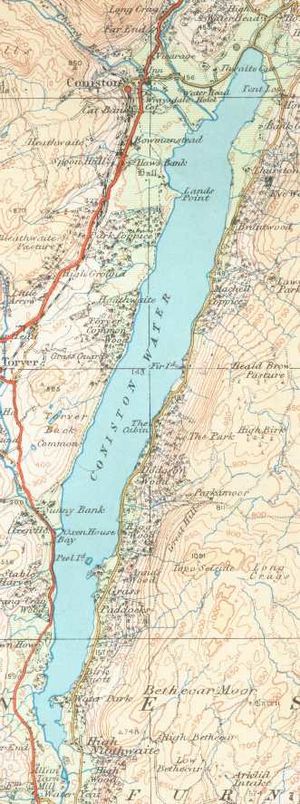
Coniston Water is a beautiful lake in Cumbria, England. It is the third largest lake in the famous English Lake District. The lake is about 8.8 kilometers (5 miles) long and 800 meters (half a mile) wide. It can get as deep as 56 meters (184 feet). Coniston Water is 44 meters (143 feet) above sea level. Its water flows out to the sea through the River Crake.
Contents
Exploring Coniston Water's Location
Coniston Water is found in the area known today as Cumbria. This region is part of the Lake District National Park. It is a popular spot for visitors who love nature and outdoor activities.
How Coniston Water Was Formed

Coniston Water is a type of lake called a "ribbon lake." These lakes are long and narrow. They are formed by glaciers. Thousands of years ago, a huge glacier carved out the valley where the lake now sits. This happened during the last ice age. The glacier scraped away rock, creating a deep, U-shaped valley.
The Old Man of Coniston
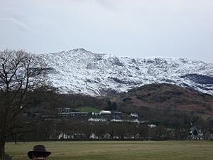
To the north-west of the lake, you can see a tall hill called the Old Man of Coniston. This is the highest point in the local group of hills known as the Coniston Fells. It's a great place for hiking!
A Look Back at Coniston Water's Past
People have lived near Coniston Water for a very long time. Settlements from the Bronze Age have been found here. This shows that people were farming in the area thousands of years ago.
Early Industries and Fishing
The Romans were active here too. They mined copper from the hills above the lake. Later, in medieval times, people continued to work with metals. They used kilns to make potash and furnaces to make iron. In the 13th and 14th centuries, the lake was important for fishing. Monks from Furness Abbey owned the lake. They relied on its fish for food. Copper mining continued in the area until the 1800s.
The Lake's Old Name
Coniston Water was once known by another name: "Thurston Water". This name came from an old Norse word, 'Thursteinn', combined with an Old English word for 'water'. People used both names until the late 1700s.
Famous Residents and Stories
The famous Victorian artist and writer John Ruskin lived at Brantwood House. This house is on the eastern shore of the lake. He lived there from 1872 until he passed away in 1900. Ruskin is buried in the churchyard in the village of Coniston, which is at the northern end of the lake.
Ruskin's secretary, W. G. Collingwood, was also a writer. He wrote a historical novel called Thorstein of the Mere. This book was about the Northmen who settled on an island in the lake.
Another artist, Henry Robinson Hall, lived in Coniston during World War I. He is also buried in the local churchyard.
Coniston Water in Children's Books
Arthur Ransome used Coniston Water as inspiration for his famous children's books. These books include Swallows and Amazons and its sequels. The stories are about school holiday adventures in the 1930s.
Ransome created a fictional lake for his books. It was a mix of Coniston Water and Windermere. The hills around the fictional lake are very much like those around Coniston Water. You can even spot some of Coniston Water's islands in the books. For example, Wild Cat Island, with its secret harbor, is based on Peel Island in Coniston Water.
Water Speed Records on Coniston

In the 20th century, Coniston Water became famous for something exciting: attempts to break the world water speed record.
Sir Malcolm Campbell's Record
On August 19, 1939, Sir Malcolm Campbell set a new record here. He reached an amazing speed of 228.108 kilometers per hour (141.74 miles per hour). He did this in his boat, the Bluebird K4.
Donald Campbell's Records
Sir Malcolm's son, Donald Campbell, continued his father's legacy. Between 1956 and 1959, Donald Campbell set four new world records on Coniston Water. He used his special boat, the Bluebird K7, which was a type of hydroplane.
Images for kids
-
View from Peel Island facing north with Helvellyn in the distant background.
 | Victor J. Glover |
 | Yvonne Cagle |
 | Jeanette Epps |
 | Bernard A. Harris Jr. |


