Cooper Creek Reservoir facts for kids
Quick facts for kids Cooper Creek Reservoir |
|
|---|---|
 |
|
| Location | Douglas County, Oregon |
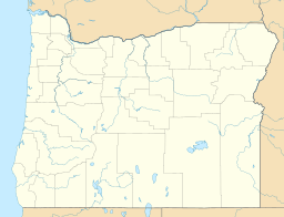
| Coordinates | 43°22′48″N 123°16′54″W / 43.38000°N 123.28167°W |
| Type | Reservoir, eutrophic |
| Primary inflows | Cooper Creek |
| Primary outflows | Cooper Creek |
| Catchment area | 4.5 square miles (12 km2) |
| Basin countries | United States |
| Surface area | 166 acres (67 ha) |
| Average depth | 23 feet (7.0 m) |
| Max. depth | 70 feet (21 m) |
| Water volume | 3,800 acre-feet (4,700,000 m3) |
| Residence time | 9 months |
| Shore length1 | 5.1 miles (8.2 km) |
| Surface elevation | 673 feet (205 m) |
| Settlements | Sutherlin |
| 1 Shore length is not a well-defined measure. | |
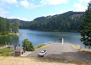
Cooper Creek Reservoir is a large body of water in Oregon, a state in the United States. It's located in Douglas County, near the town of Sutherlin. This reservoir was created by building a dam across Cooper Creek. It's an important source of drinking water for the people living in Sutherlin.
Contents
Fish and Wildlife
Cooper Creek Reservoir is home to several types of fish. You can find largemouth bass, panfish, and rainbow trout here. The rainbow trout are often added to the reservoir for fishing.
Fish Consumption Advisory
Sometimes, certain natural substances can build up in fish. Because of this, the Oregon Department of Human Services issued a health advisory in 2001. This advisory suggested that people should be careful about eating fish caught from the reservoir. However, the good news is that the drinking water from the reservoir is completely safe. Also, enjoying activities like swimming or boating in the lake is safe. Experts believe these levels in fish will likely stay the same for a long time.
Fun Activities at the Reservoir
Cooper Creek Reservoir is a great place for outdoor fun. Douglas County manages Cooper Creek Reservoir Park, which offers many activities.
Boating and Swimming
The park has two places where you can launch a boat. You can enjoy activities like waterskiing and jet skiing on the water. There's also a special area for swimming, perfect for cooling off on a warm day. A dock is available for boats.
Picnics and Hiking
If you want to relax, the park has a picnic area where you can eat outdoors. There's also a pavilion, which is a covered area, and restrooms. For those who love to explore, a hiking trail goes all the way around the reservoir. This park is only for day use, so camping overnight is not allowed.


