Corcoran, Minneapolis facts for kids
Quick facts for kids
Corcoran
|
|
|---|---|
|
Neighborhood
|
|

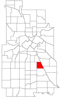
Location of Corcoran within the U.S. city of Minneapolis
|
|
| Country | United States |
| State | Minnesota |
| County | Hennepin |
| City | Minneapolis |
| Community | Powderhorn |
| City Council Ward | 9 |
| Area | |
| • Total | 0.457 sq mi (1.18 km2) |
| Population
(2020)
|
|
| • Total | 4,708 |
| • Density | 10,302/sq mi (3,978/km2) |
| Time zone | UTC-6 (CST) |
| • Summer (DST) | UTC-5 (CDT) |
| ZIP code |
55406, 55407
|
| Area code(s) | 612 |
| Historical population | |||
|---|---|---|---|
| Census | Pop. | %± | |
| 1980 | 3,760 | — | |
| 1990 | 3,635 | −3.3% | |
| 2000 | 4,228 | 16.3% | |
| 2010 | 3,942 | −6.8% | |
| 2020 | 4,708 | 19.4% | |
Corcoran is a friendly neighborhood in Minneapolis, Minnesota. It is part of the larger Powderhorn community. Corcoran is known for its cool public art and strong community spirit. People who live here often feel very connected to their neighbors.
Contents
Discovering Corcoran's Location
Corcoran is located in the city of Minneapolis. It has clear borders that help you know where it begins and ends.
Where is Corcoran?
To the east, Corcoran is next to the Longfellow and Howe neighborhoods. To the north, you'll find the Phillips neighborhood. On its west side is Powderhorn Park. Finally, to the south, it borders the Standish neighborhood.
Corcoran's Official Borders
The official lines that mark Corcoran's edges are:
- East Lake Street to the north
- Hiawatha Avenue to the east
- East 36th Street to the south
- Cedar Avenue to the west
Understanding Corcoran's Government
Corcoran is part of a specific area called a City Council Ward. This helps make sure the neighborhood has a voice in city decisions.
Who Represents Corcoran?
The entire Corcoran neighborhood is in Ward 9 of the Minneapolis City Council. The person who represents this ward is called a Council Member. Currently, Jason Chavez is the Council Member for Ward 9. He helps make decisions for the neighborhood and the city.
Important Places in Corcoran
Corcoran is home to some key spots that are important for its residents.
Minneapolis South High School
One of the main places in Corcoran is Minneapolis South High School. This is a large school where many students from the area go to learn and grow.
Midtown Farmers' Market
The neighborhood also hosts the seasonal Midtown Farmers' Market. This market is a fun place where people can buy fresh food and other items. It's a project run by the Corcoran Neighborhood Organization, which helps make the neighborhood a better place. The market happens every week during certain times of the year.
Corcoran's Growing Population
The number of people living in Corcoran has changed over the years.
How Many People Live Here?
In 2020, about 4,708 people called Corcoran home. The population has grown quite a bit since the 1980s, showing that more and more people are choosing to live in this community.
 | Sharif Bey |
 | Hale Woodruff |
 | Richmond Barthé |
 | Purvis Young |

