Powderhorn, Minneapolis facts for kids
Quick facts for kids
Powderhorn
|
|
|---|---|
|
Community
|
|

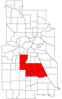
Location of Powderhorn within the U.S. city of Minneapolis
|
|
| Country | United States |
| State | Minnesota |
| County | Hennepin |
| City | Minneapolis |
| Founded | 1849 |
| City Council Wards | 8, 9, 10, 12 |
| Neighborhoods | |
| Area | |
| • Total | 4.559 sq mi (11.81 km2) |
| Population
(2020)
|
|
| • Total | 55,913 |
| • Density | 12,264.3/sq mi (4,735.3/km2) |
| Time zone | UTC-6 (CST) |
| • Summer (DST) | UTC-5 (CDT) |
| ZIP code |
55404, 55405, 55406, 55407, 55408, 55409
|
| Area code(s) | 612 |
| Historical population | |||
|---|---|---|---|
| Census | Pop. | %± | |
| 1980 | 51,519 | — | |
| 1990 | 51,954 | 0.8% | |
| 2000 | 57,299 | 10.3% | |
| 2010 | 54,743 | −4.5% | |
| 2020 | 55,913 | 2.1% | |
Powderhorn is a community in Minneapolis, Minnesota. It is made up of eight different neighborhoods. The community gets its name from Powderhorn Lake. This lake is a main feature of the Powderhorn Park today.
Powderhorn is located south of downtown Minneapolis. It is home to important places like the Minneapolis Institute of Art and the Hennepin History Museum. You can also find the Midtown Greenway trail here. Many businesses and places in Powderhorn serve people from Latin American and African backgrounds.
The Powderhorn community is represented by members of the City Council. These people are elected to help make decisions for the city. Powderhorn includes parts of Wards 8, 9, 10, and 12. The current Council Members are Andrea Jenkins, Jason Chavez, Aisha Chughtai, and Aurin Chowdhury.
Powderhorn's Neighborhoods
Powderhorn is made up of eight unique neighborhoods. Each one adds to the community's character.
Most of Powderhorn is located east of Interstate 35W. It is also generally south of Lake Street. However, two neighborhoods, Lyndale and Whittier, are west of I-35W. Whittier is also north of Lake Street.
See also
 In Spanish: Powderhorn para niños
 | Anna J. Cooper |
 | Mary McLeod Bethune |
 | Lillie Mae Bradford |

