Cordillera Domeyko facts for kids
Quick facts for kids Cordillera Domeyko |
|
|---|---|

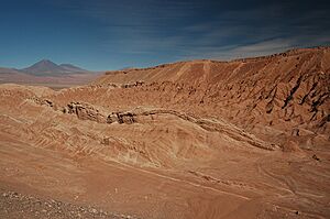
Cerro Quimal in the distance
|
|
| Highest point | |
| Peak | Cerro Quimal |
| Elevation | 4,278 m (14,035 ft) |
| Dimensions | |
| Length | 600 km (370 mi) north-south |
| Geography | |
| Country | Chile |
| Range coordinates | 24°30′S 69°00′W / 24.500°S 69.000°W |
| Parent range | Central Andes |

The Cordillera Domeyko is a long mountain range located in northern Chile. It is part of the huge Andes mountains. This range stretches for about 600 kilometers (370 miles) from north to south. It runs alongside the main Andes chain.
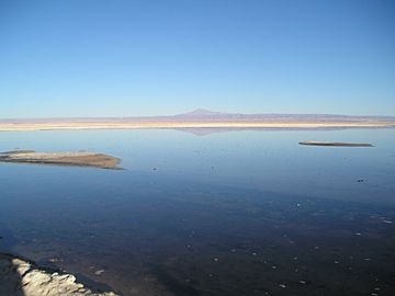
This mountain range forms the eastern edge of the flat parts of the Atacama Desert. The western side of the Cordillera Domeyko has steep cliffs. This area is known as the El Bordo Escarpment. These cliffs show many rocks from the Purilactis Group. These rocks make up a large part of the mountain range.
Why is it called Domeyko?
The Cordillera Domeyko was named after Ignacy Domeyko. He was a famous Polish scientist. He spent much of his life studying the geology and geography of Chile.
The Driest Mountains
The Cordillera Domeyko is known as the world's driest mountain range. This means it gets very little rain. It is a unique place because of its extremely dry climate.
See also
- In Spanish: Cordillera Domeyko para niños
 | Roy Wilkins |
 | John Lewis |
 | Linda Carol Brown |

