Cordillera Occidental (Colombia) facts for kids
Quick facts for kids Cordillera Occidental (Western Ranges) |
|
|---|---|
 |
|
| Highest point | |
| Peak | Cerro Tatamá |
| Elevation | 4,100 m (13,500 ft) |
| Dimensions | |
| Length | 1,200 km (750 mi) north-south |
| Area | 86,239 km2 (33,297 sq mi) |
| Geography | |
| Country | Colombia |
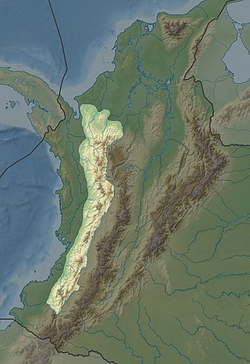
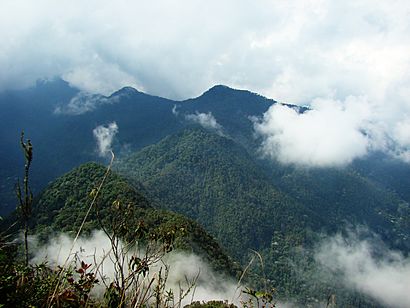
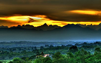
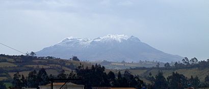
The Cordillera Occidental (which means Western Ranges) is the lowest of the three main mountain ranges in the Colombian Andes. Its average height is about 2,000 meters (6,560 feet). The tallest point is Cerro Tatamá, reaching 4,100 meters (13,450 feet) high.
This mountain range stretches from south to north across Colombia. It starts from the Colombian Massif in Nariño Department. Then it goes through Cauca, Valle del Cauca, Risaralda, Chocó, and Caldas Departments. The range ends at the Paramillo Massif in Antioquia and Córdoba Departments. From there, it splits into smaller mountain chains like Serranías de Ayapel, San Jerónimo, and Abibe. Finally, it fades into the Caribbean plain and the Sinú River valley.

Contents
Exploring the Geography of the Western Ranges
The Cordillera Occidental is a very important part of Colombia's geography. It helps divide the country into different natural areas.
Rivers and Waterways
The western side of the Cordillera Occidental is part of Colombia's Pacific region. The San Juan River is the main river here. It carries water towards the Pacific Ocean.
The eastern side of the range belongs to the Cauca River basin. This river flows north between the Cordillera Occidental and the Cordillera Central.
In the northern and northwestern parts, rivers flow towards the Atlantic Ocean. The Atrato and Sinú Rivers are the most important ones here. The Cordillera Occidental is separated from the coastal Baudó Mountains by the Atrato River.
Different Natural Areas (Ecoregions)
The Cordillera Occidental has many different types of natural environments, called ecoregions.
- The Chocó–Darién moist forests are found on the western slopes below 1,000 meters (3,280 feet). These are very wet forests.
- The Northwestern Andean montane forests cover the humid western slopes of the range. These are mountain forests.
- The Cauca Valley montane forests are on the eastern slopes.
- Northern Andean páramo covers the highest parts of the mountains. A páramo is a special type of high-altitude grassland.
Highest Peaks in the Cordillera Occidental
Here are some of the tallest mountains in the Cordillera Occidental:
- Cerro Tatamá – 4,100 meters (13,450 feet) – Located in Chocó & Risaralda
- Azufral – 4,070 meters (13,350 feet) – Located in Nariño
- Farallones de Cali – 4,050 meters (13,290 feet) – Located in Valle del Cauca
- Farallones del Citará – 4,050 meters (13,290 feet) – Located in Antioquia
- Páramo de Frontino – 3,950 meters (12,960 feet) – Located in Antioquia
- Cerro Caramanta – 3,900 meters (12,800 feet) – Located in Antioquia, Caldas & Risaralda
- Cerro Napi – 3,860 meters (12,660 feet) – Located in Cauca
- Alto Musinga – 3,850 meters (12,630 feet) – Located in Antioquia
- Cerro Calima – 3,840 meters (12,600 feet) – Located in Valle del Cauca
- Cerro Paramillo – 3,730 meters (12,240 feet) – Located in Antioquia
- Cerro Ventana – 3,450 meters (11,320 feet) – Located in Valle del Cauca & Chocó
Protecting Nature: National Parks and Reserves
Many parts of the Cordillera Occidental are protected areas. These places help save unique plants, animals, and natural landscapes.
National Protected Areas
These are large areas protected by the national government, listed from south to north:
- PNN Munchique
- PNN Farallones de Cali
- PNN Tatamá
- PNN Las Orquídeas
- PNN Paramillo
Other areas that might become national parks in the future include:
- Serranía del Pinche
- Serranía de los Paraguas
Local Protected Areas
Some areas are protected by local governments or organizations:
- Yotoco Forest Reserve
- Bitaco River Forest Reserve
Fun and Recreation in the Western Ranges
The Cordillera Occidental also offers places for people to relax and enjoy nature:
- Dapa
- Calima Lake
See also
- Geography of Colombia
- Andean Region, Colombia
- Cordillera Central (Colombia)
- Cordillera Oriental (Colombia)
 In Spanish: Cordillera Occidental (Colombia) para niños
 | William L. Dawson |
 | W. E. B. Du Bois |
 | Harry Belafonte |


