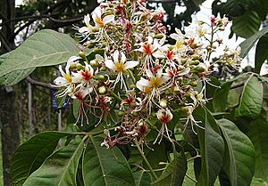
Chocó–Darién moist forests facts for kids
Quick facts for kids Chocó–Darién moist forests (NT0115) |
|
|---|---|
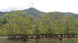
Mangroves fringing the Utría National Natural Park
|
|
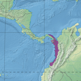
Ecoregion territory (in purple)
|
|
| Ecology | |
| Realm | Neotropical |
| Biome | Tropical and subtropical moist broadleaf forests |
| Bird species | 577 |
| Geography | |
| Area | 73,556 km2 (28,400 sq mi) |
| Countries | Colombia, Panama |
| Coordinates | 6°19′12″N 76°50′42″W / 6.32°N 76.845°W |
| Geology | Chocó and Tumaco Basins |
| Climate type | Af: equatorial; fully humid |
| Conservation | |
| Conservation status | Relatively stable/intact |
| Protected | 15.26% |
The Chocó–Darién moist forests (NT0115) are a special ecoregion. They are found in western Colombia and eastern Panama. This area gets a lot of rain, and its forests are home to an incredible variety of plants and animals. It's like a giant, natural treasure chest!
While some parts of this forest have been changed by farming and ranching, and there are threats like logging and mining, the middle part is still mostly untouched and wild.
Contents
Geography
Where is this amazing forest?
The Chocó–Darién moist forests stretch along most of Colombia's Pacific coast. They also go north into Panama, touching the Caribbean coast.
These forests cover about 7.3 million hectares (that's over 18 million acres!). In Colombia, you'll find them in the Chocó, Cauca, Valle del Cauca, and Nariño areas. In Panama, they are in the Darién and Guna Yala areas.
To the east, big mountains called the Andes separate these forests from other regions. Along the coasts, you can also find areas of mangrove forests.
What is the land like?
This ecoregion sits between the Pacific Ocean and the Western Andes mountains. The land goes from sea level up to about 1,000 meters (3,300 feet) high. It includes mountain ranges like the Serranía del Darién and Serranía del Baudó.
The land here has different features. You'll find new plains formed by rivers, hills made from old sediments, and even older rocks in the mountains. The soil is usually red clay. Heavy rain washes away many nutrients from the soil. However, newer and richer soils are found near the Andes and along the main rivers.
This region also includes the basins of large rivers like the Atrato River in the north. Further south are the San Juan and Patía rivers. The huge amount of rain gives these rivers great power. They cut deep paths through the mountains, creating amazing waterfalls and rapids. Lower down, the rivers become wider and wind through the flat plains.
What is the climate like?
The Chocó–Darién moist forests have a very wet and warm climate. The average temperature is about 23.6°C (74.5°F). It usually stays between 18.6°C (65.5°F) and 30°C (86°F).
This area gets a lot of rain, from 4,000 to 9,000 millimeters (157 to 354 inches) each year! The central part gets the most rain, sometimes as much as 13,000 millimeters (512 inches). The northern and southern parts are a bit drier. They might even have a short dry season from January to March.
Ecology
The Chocó–Darién moist forests are part of the Neotropical realm. They are known as some of the richest rainforests in the world. This ecoregion is also part of a special area called the Tumbes–Chocó–Magdalena biodiversity hotspot. This means it has a huge number of different plant and animal species, many of which are found nowhere else.
Amazing Plants
There are at least 8,000 different kinds of plants in these forests. Some experts think there might be over 10,000! Almost 20% of these plants are found only here.
The types of plants you see depend on how high up you are, how much water there is, and how close it is to the sea. Many species are "endemic," meaning they live only in small parts of this region. This makes each area a bit different.
The lowland rainforests in the north have tall trees like the cow tree and wild cashew. You can also see huge emergent trees that stand taller than the rest of the forest canopy. The southern rainforests also have very tall trees, with many climbing plants called lianas and plants that grow on other plants, called epiphytes.
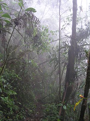
In the central zone, you find forests at higher altitudes. These areas can look like cloud forests, with thick moss and other plants growing on tree trunks and branches.
Wonderful Animals
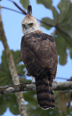
The Chocó–Darién moist forests are home to a wide variety of animals. Many of them are found only in this region. The extremely heavy rainfall can make it hard for some animals to travel, creating gaps in where they live.
Some of the amazing mammals that live here, but are in danger, include the Geoffroy's tamarin (a small monkey), the giant anteater, the cougar, the ocelot, and the mighty jaguar. Other endangered mammals are the black-headed spider monkey and Baird's tapir.
A huge number of birds live here, with 577 different species recorded! The most common bird family is the tyrant flycatcher. This ecoregion is a special place for birds, with at least 60 species found only here. Some of these unique birds include the Choco tinamou and the Baudó oropendola. Rare birds like the powerful harpy eagle also live in these forests.
The forests are also home to 97 types of reptiles, including many snakes and lizards. Some endangered reptiles are Dunn's spinytail lizard. There are at least 127 types of amphibians, like frogs and toads. Many of these amphibians are endangered, such as the elegant stubfoot toad and the golden poison frog.
Status
The World Wide Fund for Nature (WWF) says this region is "Relatively Stable/Intact." This means it's still in pretty good shape overall.
However, some parts of the forest have been changed. In the northern areas of Colombia, much of the forest has been replaced by banana farms and cattle ranches. In the south, some areas have been cleared for oil palm farms or for wood to make paper.
Most of the untouched forest is in the central part of the ecoregion. In the past, the remaining forest areas were large and connected, which is good for wildlife. This region also has great potential for scientific research and for ecotourism, where people visit to enjoy nature responsibly. Some areas of forest that have grown back are almost 500 years old, which is amazing for studying how tropical forests recover.
In the past, about 10% to 20% of the original forest had been destroyed. The Chocó forests provide half of Colombia's wood. The biggest threats come from cutting down trees and the soil washing away because of it. Building roads, like the Inter-American Highway in the Darien region, also harms the habitat. Other threats include large farms for African oil palm, gold mining, and growing coca plants.
About 30% of the ecoregion in Panama is protected in some way. The huge Darién National Park is a special place. It is even recognized as a World Heritage Site by UNESCO. Other protected areas in Panama include indigenous reserves, which are lands managed by local communities.
In Colombia, some parts of the ecoregion are protected by national parks. These include Los Katíos National Park, which is next to Darién National Park in Panama. Other important parks are Ensenada de Utria National Park and Sanquianga National Natural Park.
See also
 In Spanish: Bosques húmedos del Chocó-Darién para niños
 | Aaron Henry |
 | T. R. M. Howard |
 | Jesse Jackson |


