Costa Rica–Panama border facts for kids
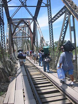
The Costa Rica–Panama border is a line that separates two countries: Costa Rica and Panama. It stretches for about 348 kilometers (216 miles). This border goes from the Caribbean Sea on one side all the way to the Pacific Ocean on the other.
Contents
The Border Between Costa Rica and Panama
How the Border Was Decided
The way the border is today was set by a special agreement called the Echandi-Fernandez Treaty. This treaty was signed in 1941. It clearly describes exactly where the border should be.
Where the Border Runs
The border between Costa Rica and Panama crosses different types of land. It goes through mountains and follows rivers. Here's how the 1941 treaty describes it:
- It begins where the Sixaola River meets the Caribbean Sea.
- Then, it follows the valley of the Sixaola River.
- It continues along this river until it meets the Yorkin River.
- From there, the border goes up the Yorkin River valley.
- It stops at a specific imaginary line called a parallel, at 9°30'N latitude.
- Next, it goes in a straight line to another imaginary line called a meridian, at 82°58'10"W longitude.
- From that point, it goes south along this meridian.
- It reaches the top of the Cordillera de Talamanca mountains. These mountains separate rivers that flow to the Caribbean from those that flow to the Pacific.
- The border then follows this mountain ridge to Mount Pano.
- At Mount Pano, it meets another ridge. This ridge divides the waters that flow into the Golfo Dulce from those that flow into the Charco Azul Bay.
- Finally, it follows this last ridge all the way to Punta Burica. This point is on the Pacific Ocean coast.
See also
 In Spanish: Frontera entre Costa Rica y Panamá para niños
Black History Month on Kiddle
Famous African-American Scientists:
 | Percy Lavon Julian |
 | Katherine Johnson |
 | George Washington Carver |
 | Annie Easley |

All content from Kiddle encyclopedia articles (including the article images and facts) can be freely used under Attribution-ShareAlike license, unless stated otherwise. Cite this article:
Costa Rica–Panama border Facts for Kids. Kiddle Encyclopedia.

