
Sixaola facts for kids
Quick facts for kids
Sixaola
|
|
|---|---|
|
District
|
|

Sixaola
Location in Costa Rica
|
|
| Country | |
| Province | Limón |
| Canton | Talamanca |
| Creation | 19 February 1970 |
| Area | |
| • Total | 169.32 km2 (65.37 sq mi) |
| Elevation | 10 m (30 ft) |
| Population
(2011)
|
|
| • Total | 8,861 |
| • Density | 52.333/km2 (135.541/sq mi) |
| Time zone | UTC−06:00 |
| Postal code |
70402
|
Sixaola is a small town in Costa Rica. It is a district within the Talamanca area, located in the Limón province. Sixaola sits right on the border with Panamá. The Sixaola River flows between Sixaola in Costa Rica and Guabito, a town in Panama.
Contents
History of Sixaola
Sixaola became an official district on February 19, 1970. This happened because of a special government decision.
Geography of Sixaola
Sixaola covers an area of about 169 square kilometers (about 65 square miles). It is also quite low to the ground, only about 10 meters (33 feet) above sea level.
Villages in Sixaola
Many smaller villages make up the Sixaola district. Some of these are:
- Ania
- Boca Sixaola
- Catarina
- Celia
- Daytonia
- Gandoca
- Margarita
- Mata de Limón
- Noventa y Seis
- Palma
- Paraíso
- Parque
- San Miguel
- San Miguelito
- San Rafael
- Virginia
- Zavala
People of Sixaola
| Historical population | |||
|---|---|---|---|
| Census | Pop. | %± | |
| 1973 | 1,096 | — | |
| 1984 | 3,462 | 215.9% | |
| 2000 | 10,234 | 195.6% | |
| 2011 | 8,861 | −13.4% | |
|
Instituto Nacional de Estadística y Censos |
|||
In 2011, a count of people called a census showed that Sixaola had 8,861 residents. The area around Sixaola is also home to the Bribri Indians, who are an indigenous group.
Getting Around Sixaola
Road Connections
The main road that goes through Sixaola is:
- National Route 36

This road continues into Panama, where it becomes Panama Route 1001.
Economy and Tourism
Border Crossing for Travelers
Many tourists travel through Sixaola and Guabito. They use a road that connects places in Costa Rica's Limón Province with Panama's Bocas del Toro Province. This road used to be an old railroad track.
An old railroad bridge crosses the Rio Sixaola right at the border. When people cross the border, they need to check in with customs officials from both Costa Rica and Panama. You might also need special entry or exit papers called visas.
The towns of Sixaola and Guabito do not have hotels, restaurants, or other services for travelers. In Costa Rica, the closest places with these services are in Puerto Viejo. In Panama, you can find hotels and restaurants in Changuinola, which is about 10 kilometers (6 miles) from the border. Buses and taxis are available on both sides of the border to help people travel.
Images for kids
-
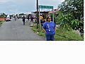
Entrance to Sixaola

See also
 In Spanish: Sixaola (Costa Rica) para niños
