Coulterville, California facts for kids
Quick facts for kids
Coulterville
|
|
|---|---|

Coulterville Main Street Historic District
|
|
| Country | |
| State | |
| County | Mariposa County |
| Area | |
| • Total | 0.39 sq mi (1.01 km2) |
| • Land | 0.39 sq mi (1.01 km2) |
| • Water | 0.00 sq mi (0.00 km2) 0.02% |
| Elevation | 1,699 ft (518 m) |
| Population
(2020)
|
|
| • Total | 115 |
| • Density | 295.63/sq mi (114.15/km2) |
| Time zone | UTC-8 (Pacific (PST)) |
| • Summer (DST) | UTC-7 (PDT) |
| ZIP Code |
95311
|
| Area code(s) | 209 |
| FIPS code | 06-16644 |
| GNIS feature IDs | 266604 2582984 |
| Reference #: | 332 |
Coulterville is a small community in Mariposa County, California, United States. It used to be called Maxwell's Creek. This town is located about 20 miles (32 km) northwest of Mariposa. It sits at an elevation of 1,699 feet (518 meters) above sea level.
Coulterville is known as a historic mining town. It is nestled in the foothills of the Sierra Nevada mountains. In 2020, about 115 people lived there. The area's ZIP Code is 95311, and the phone area code is 209.
Contents
History of Coulterville
Coulterville was first settled in 1850. It was founded by a man named George W. Coulter, and the town was named after him. For a while, George Coulter lived in a tent that flew the American flag. Because of this, local Mexican residents called the place Banderita. This is a Spanish word meaning "small flag."
The town's first post office opened in 1852 and was called Maxwell's Creek. In 1853, its name was changed to Coulterville. The name "Maxwell" honored George Maxwell. He was a friend of George Coulter, and they even cast lots to decide the town's name.
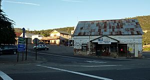
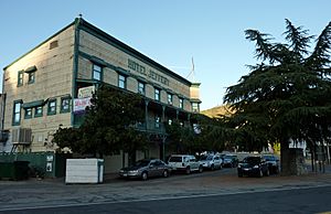
Coulterville is a very important historical site. It is officially recognized as California Historical Landmark #332. A large part of the downtown area is also listed on the National Register of Historic Places. This means its historic buildings are protected.
Geography and Location
Coulterville is a small place. According to the United States Census Bureau, the community covers an area of about 0.39 square miles (1.01 square kilometers). This area is smaller than it was in 2010.
Climate in Coulterville
Coulterville has a climate with warm summers and mild, wet winters. Here is a look at the average temperatures and rainfall:
| Climate data for Coulterville, California | |||||||||||||
|---|---|---|---|---|---|---|---|---|---|---|---|---|---|
| Month | Jan | Feb | Mar | Apr | May | Jun | Jul | Aug | Sep | Oct | Nov | Dec | Year |
| Mean daily maximum °F (°C) | 55 (13) |
57 (14) |
61 (16) |
67 (19) |
76 (24) |
86 (30) |
93 (34) |
93 (34) |
89 (32) |
77 (25) |
64 (18) |
54 (12) |
73 (23) |
| Mean daily minimum °F (°C) | 35 (2) |
36 (2) |
39 (4) |
41 (5) |
47 (8) |
54 (12) |
62 (17) |
61 (16) |
56 (13) |
47 (8) |
40 (4) |
34 (1) |
46 (8) |
| Average precipitation inches (mm) | 5.6 (140) |
4.8 (120) |
4.5 (110) |
2.4 (61) |
1.2 (30) |
0.3 (7.6) |
0.05 (1.3) |
0.05 (1.3) |
0.2 (5.1) |
1.4 (36) |
2.6 (66) |
4.9 (120) |
28 (698.3) |
| Average snowfall inches (cm) | 0.5 (1.3) |
0.9 (2.3) |
0.5 (1.3) |
0.0 (0.0) |
0.0 (0.0) |
0.0 (0.0) |
0.0 (0.0) |
0.0 (0.0) |
0.0 (0.0) |
0.0 (0.0) |
0.1 (0.25) |
0.9 (2.3) |
2.9 (7.45) |
| Source: prism | |||||||||||||
Population Information
| Historical population | |||
|---|---|---|---|
| Census | Pop. | %± | |
| 2010 | 201 | — | |
| 2020 | 115 | −42.8% | |
| U.S. Decennial Census | |||
In 2010, the population of Coulterville was 201 people. By 2020, it had decreased to 115 people.
Most of the people living in Coulterville are White. A small number of residents are Native American or Asian. About 10% of the population is of Hispanic or Latino background.
In 2010, about 15% of the people living in Coulterville were under 18 years old. About 22% were 65 years or older. The average age in the town was 52.9 years.
See also
 In Spanish: Coulterville (California) para niños
 | Selma Burke |
 | Pauline Powell Burns |
 | Frederick J. Brown |
 | Robert Blackburn |


