
County of Cavendish facts for kids
Quick facts for kids CavendishQueensland |
|||||||||||||||
|---|---|---|---|---|---|---|---|---|---|---|---|---|---|---|---|

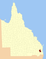
Location within Queensland
|
|||||||||||||||
|
|||||||||||||||
The County of Cavendish is a special kind of area in Queensland, Australia. It's called a county, but it's not like the counties you might hear about in other countries. In Queensland, these counties are mostly used for keeping track of land.
This means the County of Cavendish isn't a place with its own government or mayor. Instead, it helps people register who owns which piece of land. It covers parts of the Toowoomba Region and the Somerset Region in Queensland. The county was officially named and its boundaries set on March 7, 1901. This was done by the Governor of Queensland under a law called the Land Act 1897.
Contents
What is a County in Queensland?
In Queensland, a county is a way to divide up land on maps. Think of it like a big grid system. These divisions help the government keep records of land ownership. They also help when selling or buying land.
Even though they are called counties, they don't have their own local councils. They are just lines on a map that help with land administration. This system has been used for a long time to organize land in Australia.
Where is Cavendish County Located?
The County of Cavendish is found in the southeastern part of Queensland. It stretches across two important areas. These are the northern part of the Toowoomba Region and the western part of the Somerset Region.
This location places it in a diverse area of Queensland. It includes both rural landscapes and some smaller towns. The county's boundaries connect it to several other counties. These include Fitzroy, Canning, Aubigny, Churchill, and Stanley.
History of Cavendish County
The County of Cavendish was officially created over 120 years ago. This happened on March 7, 1901. At that time, the government was setting up clear boundaries for land. This was important for managing the growing state of Queensland.
The Land Act 1897 was the law that allowed this to happen. The Governor in Council made the final decision. This means the Governor, with advice from government ministers, approved the county's name and borders. This helped to bring order to land records.
Smaller Areas: Parishes
Just like a big county can be divided, the County of Cavendish is also split into smaller sections. These smaller areas are called parishes. Parishes are even tinier divisions of land. They help to pinpoint specific locations.
Many towns and communities are located within these parishes. For example, towns like Toogoolawah, Crows Nest, and Esk are found within different parishes of Cavendish County. These parishes are also used for land registration. They help make sure every piece of land has a clear address and record.
Images for kids
-
Location within Queensland
