Courtenay, New Zealand facts for kids
Quick facts for kids
Courtenay
|
|
|---|---|
|
settlement
|
|

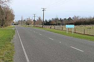
Old West Coast Road passing through Courtenay
|
|
| Country | New Zealand |
| Region | Canterbury |
| Territorial authority | Selwyn District |
| Time zone | UTC+12 (NZST) |
| • Summer (DST) | UTC+13 (NZDT) |
| Postcode |
7671
|
| Area code(s) | 03 |
| Local iwi | Ngāi Tahu |
Courtenay is a small community located inland in Canterbury, New Zealand. It used to be a very important spot because people could cross the Waimakariri River there. It was also a popular stop for coaches traveling to the West Coast. However, when the Midland railway was built through a different town called Kirwee, Courtenay became less busy.
Contents
Courtenay's Early Days
Early settlers in Canterbury found it hard to cross the Waimakariri River. In 1849, a surveyor named Joseph Thomas named the river "Courtenay River." He named it after Lord Courtenay, who was part of the Canterbury Association.
However, the name "Courtenay River" didn't stick. People soon went back to calling it by its Māori name, Waimakariri. The best place to cross the river was about 35 kilometers from Christchurch. A settlement grew up on the south side of the river at this crossing point. This settlement then took the name Courtenay.
When Christchurch needed more wood for building, logs from the Harewood Forest near Oxford were brought across the river at Courtenay.
Farming and First Settlers
Courtenay is a very good area for farming. It was originally part of large farms called Racecourse Hill and Desert runs. One of the first people to settle here was Colonel De Renzie Brett.
Coaches and Hotels
In 1861, a hotel was built in Courtenay. It was run by Charles White. A store also opened in the town. This was when Cobb & Co coaches traveled through Courtenay on their way to the West Coast.
Another hotel, called the Halfway House, was opened by Charles Watson just east of Courtenay. It was named this because it was halfway between Christchurch and Sheffield. Cobb & Co coaches would stop there for breakfast on their journey from Christchurch.
Changes and Decline
The railway line to Springfield was built through Kirwee instead of Courtenay. This meant that the coach traffic stopped coming through Courtenay. Because of this, the hotel and store eventually closed down.
The Courtenay Road Board, which looked after the district's roads, used to meet at the Courtenay Hotel. Later, their main office moved to Kirwee. Local farming and gardening groups also started in Courtenay but later moved their shows to Kirwee.
Local Buildings and History
St. Matthew's Church is an Anglican church in Courtenay. It is located where Halkett and Woolshed Roads meet. Courtenay also had a special kind of school called a "country model school." This was a place where new teachers could learn by working with experienced teachers. The school closed a long time ago, but the building is still there.
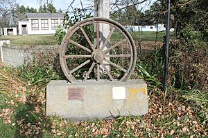
In 2000, Courtenay celebrated 150 years of its history. A special memorial is located next to the Old West Coast Road to mark this occasion.
The Waimakariri River and Floods
The Waimakariri River makes a big curve across the Canterbury Plains. Courtenay is located right on the outer edge of this curve. The land near the river is low, and you can still see old flood channels from the air.
People knew there was a risk of floods early on. However, nothing was done until a huge flood hit Christchurch in February 1868. During this flood, Victoria Square was about 1 meter underwater. The Waimakariri floodwaters even reached the start of the Avon River in Avonhead. Water quickly rose in central Christchurch. After this big flood, the Canterbury Provincial Council built flood banks to protect the area.
Courtenay Electorate
The Courtenay district also gave its name to a special voting area, or electorate, for the New Zealand Parliament. This electorate was created in 1902 and existed for two terms of Parliament. It was then removed in 1908.


