Cromarty Firth facts for kids
Quick facts for kids Cromarty Firth |
|
|---|---|
| Location | Scotland, United Kingdom |
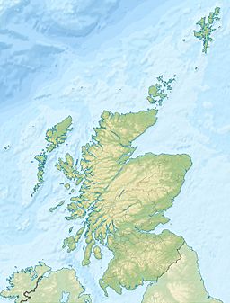
| Coordinates | 57°41′N 4°07′W / 57.683°N 4.117°W |
| Designated: | 22 July 1999 |
| Reference #: | 1001 |
The Cromarty Firth ( Scottish Gaelic: Caolas Chrombaidh) is a long, narrow arm of the sea in Scotland. It's like a big inlet connected to the Moray Firth. Its name comes from the Scottish Gaelic words meaning "straits of Cromarty".
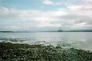
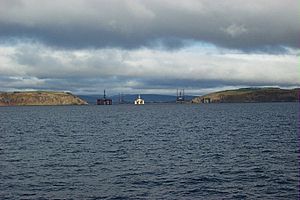
Looking from Invergordon toward oil drilling rigs in the Cromarty Firth.
|
Contents
Exploring the Cromarty Firth's Landscape
The entrance to the Cromarty Firth is guarded by two tall hills. These hills are called "The Sutors". The northern one is about 151 metres (495 ft) high, and the southern one is about 141 metres (463 ft) high. They look a bit like two shoemakers bent over their work. In old Scottish language, shoemakers were called souters.
From these hills, the Firth stretches inland for about 30.6 kilometres (19 miles). For most of its length, it's about 1.6 kilometres (1 mile) wide. However, in some places, it gets wider. For example, between Nigg Bay and Cromarty Bay, it's about 8 kilometres (5 miles) wide.
The southern side of the Firth is formed by a piece of land called the Black Isle. You can get great views of the Cromarty Firth from The Sutors or from a place called Cnoc Fyrish.
Rivers and Towns of the Firth
Several rivers flow into the Cromarty Firth. The main river is the River Conon, which joins the Firth at its far end. Other rivers include the Allt Graad, Peffery, Sgitheach, Averon, and Balnagown.
The Dingwall Canal is also connected to the Firth, but it's not used for boats anymore. The main towns along the shores are Dingwall, Cromarty, and Invergordon. The villages of Evanton, Alness, and Culbokie are also nearby.
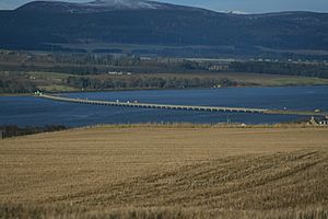
There is one bridge, the A9 road bridge, which crosses the Firth between Ardullie and Findon. In the past, many ferries crossed the Firth. Today, only one small ferry operates in the summer. It carries about four cars between Cromarty and Nigg.
Wildlife and Nature in the Firth
The Cromarty Firth is a very important place for wildlife. It is protected as a Special Protection Area. This means it's a special place for animals and plants.
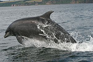
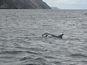
Many amazing sea creatures live here all the time. You can often see bottlenose dolphins, harbour porpoises, grey seals, and harbour seals.
Bigger animals visit the Firth at certain times of the year. These include minke whales and sometimes even humpback whales. Other visitors can be northern bottlenose whales, long-finned pilot whales, and common dolphins. Large fish like the sunfish and basking sharks also come to the Firth.
History of the Cromarty Firth
The Cromarty Firth has always been a very safe place for ships to anchor. This made it important for navies. Invergordon was once a big base for the Royal Navy's Home Fleet.
During World War II, there was a large training base for Catalina and Sunderland seaplanes. These were planes that could land and take off from water. This base stretched from Invergordon to Alness point. Today, this area is an industrial estate.
A memorial was put up in 2001 to remember the people who died on missions from this base. A propeller from a Catalina plane was found and fixed up by RAF apprentices. It is now in the town of Alness.
Industry and Business in the Firth
At a place called Nigg, there is a very important centre for North Sea oil and renewable energy. This area is now called Nigg Energy Park. It has a special dry dock where oil platforms can be repaired and built. This yard first opened in 1972.
Other parts of the Firth have facilities for different kinds of business. There are places for large cruise ships to dock. There are also facilities for processing oil and handling large amounts of cargo.
The Cromarty Firth Port Authority is the group that manages all the business and industry in the Firth. They make sure everything runs smoothly and safely.
 | Laphonza Butler |
 | Daisy Bates |
 | Elizabeth Piper Ensley |


