Crooked Creek, Alaska facts for kids
Quick facts for kids
Crooked Creek
Qipcarpak
|
|
|---|---|

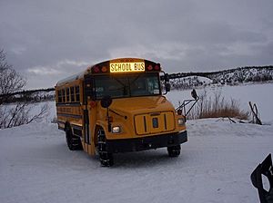
School bus service at Crooked Creek
|
|

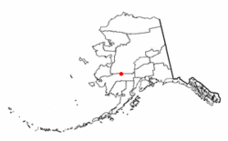
Location of Crooked Creek, Alaska
|
|
| Country | United States |
| State | Alaska |
| Census Area | Bethel |
| Area | |
| • Total | 107.39 sq mi (278.13 km2) |
| • Land | 99.83 sq mi (258.55 km2) |
| • Water | 7.56 sq mi (19.59 km2) |
| Population
(2020)
|
|
| • Total | 90 |
| • Density | 0.90/sq mi (0.35/km2) |
| Time zone | UTC-9 (Alaska (AKST)) |
| • Summer (DST) | UTC-8 (AKDT) |
| ZIP code |
99575
|
| Area code(s) | 907 |
| FIPS code | 02-17850 |
Crooked Creek (which is called Central Yupik: Qipcarpak in the local language) is a small community in Alaska, United States. It's known as a census-designated place (CDP). This means it's an area that the government counts for population, but it's not officially a city or town. It is located in the Bethel Census Area.
In 2010, about 105 people lived there. By 2020, the population was 90 people.
Contents
Where is Crooked Creek?
Crooked Creek is found in a beautiful part of Alaska. It sits on the north bank of the Kuskokwim River. This river is very important for transportation and life in the area. The community is also at the mouth of a smaller stream, also called Crooked Creek. This area is surrounded by the Kuskokwim Mountains.
The community is about 120 miles (193 km) northeast of Bethel. Bethel is a larger town further down the Kuskokwim River.
The total area of Crooked Creek is about 107.4 square miles (278.1 square kilometers). Most of this area is land, about 99.8 square miles (258.5 square kilometers). The rest is water, which includes parts of the Kuskokwim River and other small waterways.
Who Lives in Crooked Creek?
Crooked Creek first appeared on the U.S. Census in 1940. Back then, it was just a small village. In 1980, it became a census-designated place (CDP).
The population has changed over the years:
| Historical population | |||
|---|---|---|---|
| Census | Pop. | %± | |
| 1940 | 48 | — | |
| 1950 | 43 | −10.4% | |
| 1960 | 92 | 114.0% | |
| 1970 | 59 | −35.9% | |
| 1980 | 108 | 83.1% | |
| 1990 | 106 | −1.9% | |
| 2000 | 137 | 29.2% | |
| 2010 | 105 | −23.4% | |
| 2020 | 90 | −14.3% | |
| U.S. Decennial Census | |||
In 2000, there were 137 people living in Crooked Creek. Most of the people living there were Native American, making up about 90.5% of the population. About 6.6% were White, and a small number were from two or more racial backgrounds.
Many households in Crooked Creek had children under 18 living with them. The average household had about 3 to 4 people. The community is home to many young people. In 2000, about 41.6% of the population was under 18 years old. The median age was 25 years.
Life and Services
Life in Crooked Creek is different from many larger towns. As of 2009, not all homes had running water or indoor plumbing. The school, teacher housing, a place called the "washeteria," a lodge, and the local store had these services. Many homes used a system called a honey bucket for waste.
People often got water for their homes from the Kuskokwim River. They could also buy water at the Washeteria. The Washeteria is a special building where people can do their laundry using washers and dryers. They can also take showers there.
The community has a few important places:
- A local store where people can buy supplies.
- A "lodge," which is like a small hotel or bed and breakfast for visitors.
- A school for the children.
- The Washeteria for water and laundry services.
In terms of communication, cell phone service became available in January 2017. Landline phone service is also an option. Internet access is available at the school and has become available for private homes too.
Education in Crooked Creek
The children of Crooked Creek attend the Johnnie John Sr. School. This school is part of the Kuspuk School District. It teaches students from kindergarten all the way through 12th grade. In December 2017, there were about 22 students at the school.
See also
 In Spanish: Crooked Creek (Alaska) para niños
 | Janet Taylor Pickett |
 | Synthia Saint James |
 | Howardena Pindell |
 | Faith Ringgold |

